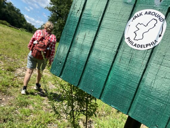
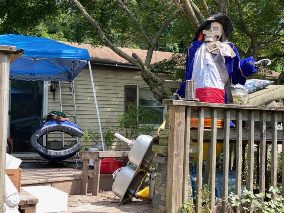
The first weekend of this fall’s 10 x 10 edition of Walk Around Philadelphia is was pretty fantastic.
Each route offered surprises, challenges, contrasts and unexpected delights (as expected!)
There’s seven more segments open for you to join (Sept 18/19, 25/26/27 and Oct 2/3) alongside an option to organize your own group, so head on over to FringeArts to register to join us now…and/or sign up for the virtual reportback via zoom on October 3rd to hear more of these intrepid explorers’ stories…
Meanwhile, see below for a quick recap of the first weekend…
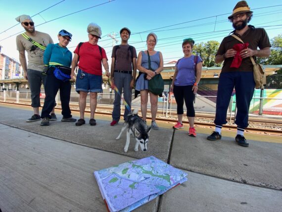
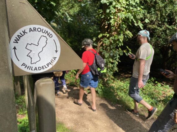
Segment 1:
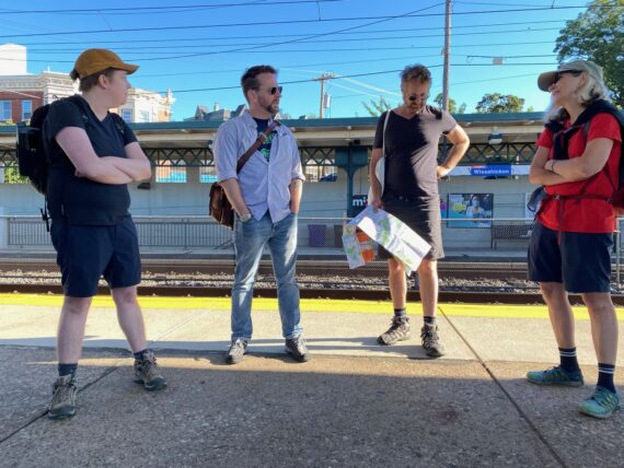
61st & Baltimore towards Wissahickon Station
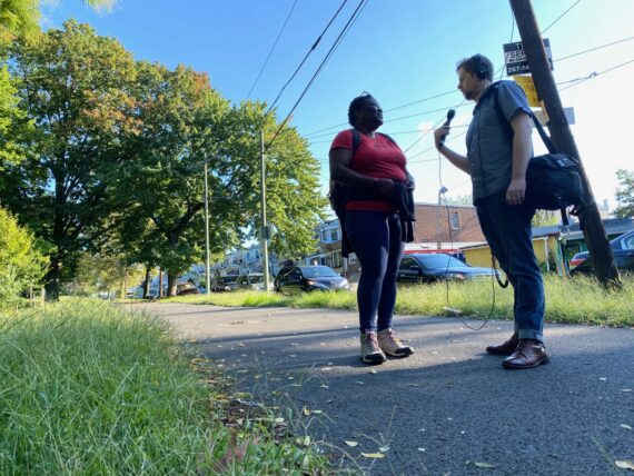
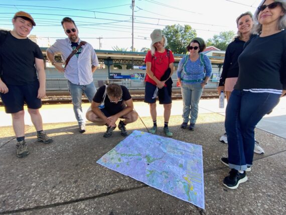
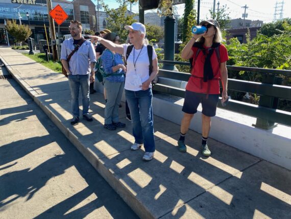
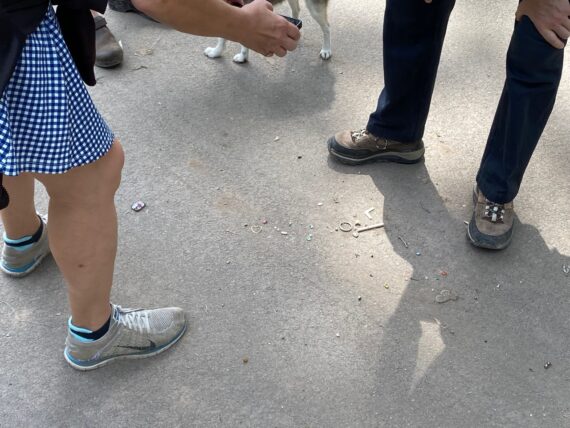
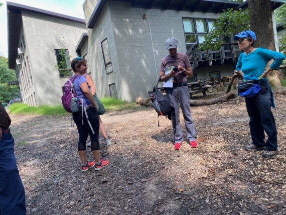
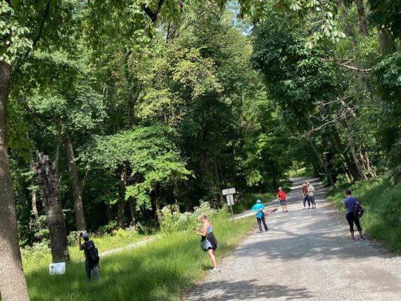
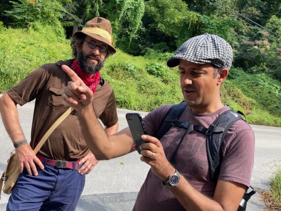
We were met bright and early by WHYY’s Aaron Moselle who interviewed a few of us about our plans to set out and explore the city’s edge…
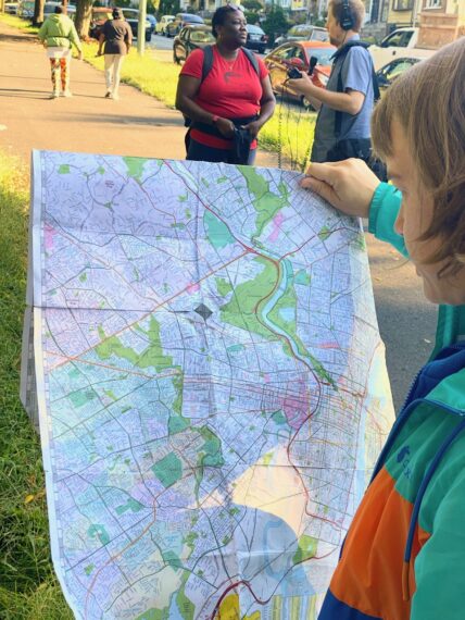
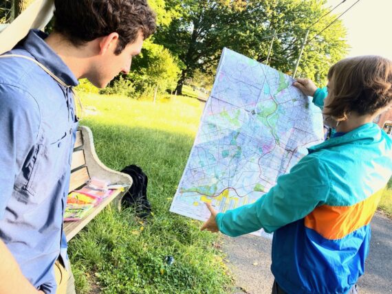
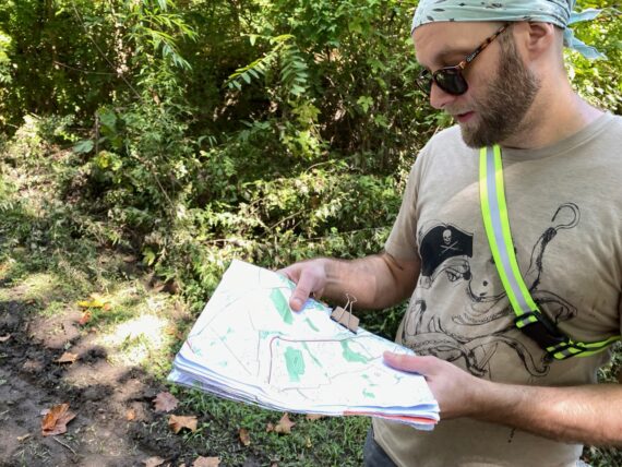
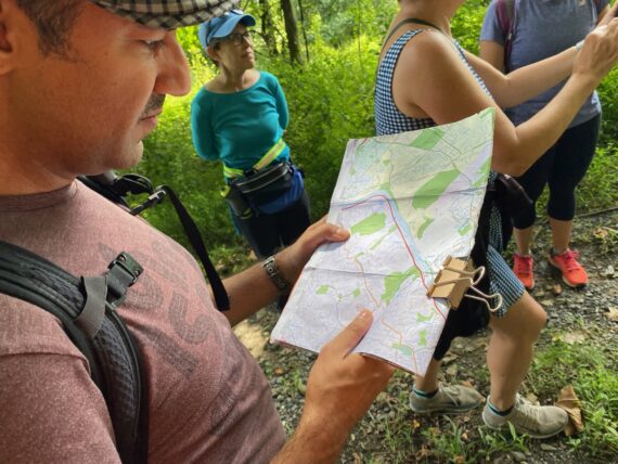
… and we took some time with the map to review our route.
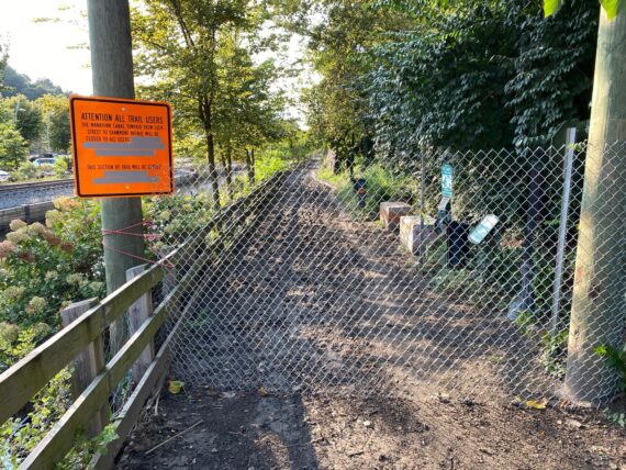
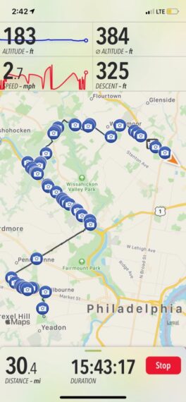
This fall Fringe version of the walk is divided into ten segments of roughly ~10 miles each. These segments are more accessible than the long ~20 mile days of this past February, but slightly longer than the ~4-7 mile segments that the NCC’s high school students divided the route into when they completed the full perimeter over 15 days last fall.
Of course, if you choose the “DIY/Anytime” registration, you can create any segment that you’d like. And as I continue to develop this project, I plan on mapping out shorter segments to facilitate even more accessibility.
(I’m also fundrasing to continue to develop this project & increase accessibility. Care to chip in here?)
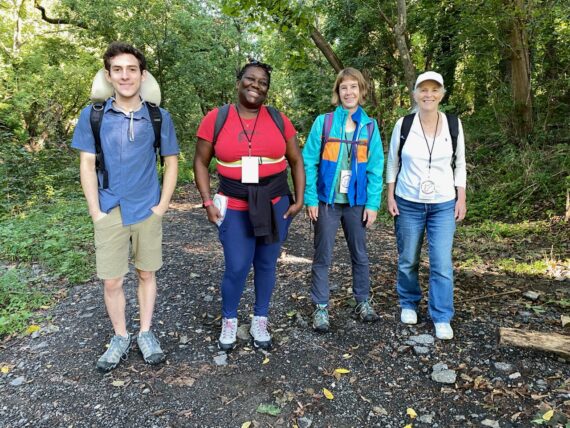
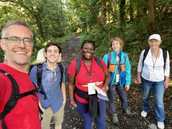
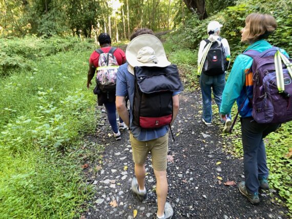
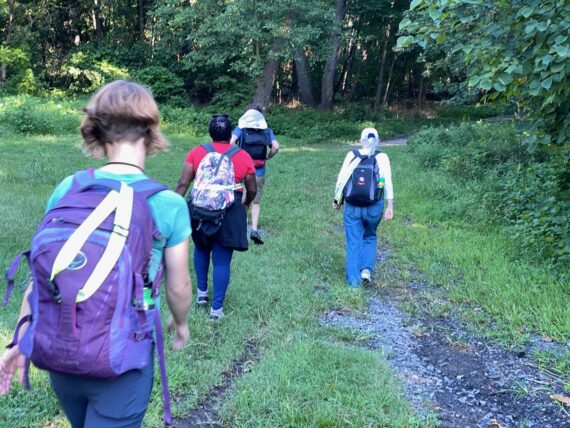
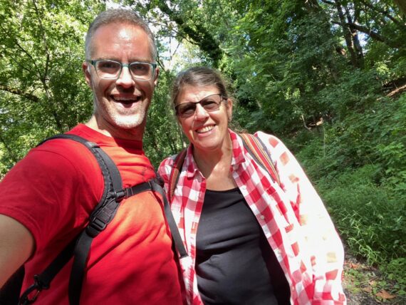
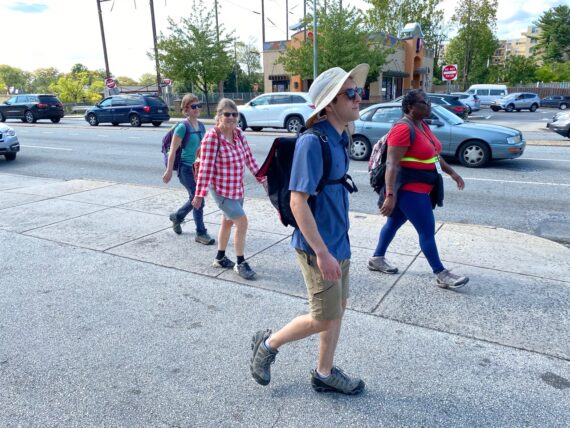
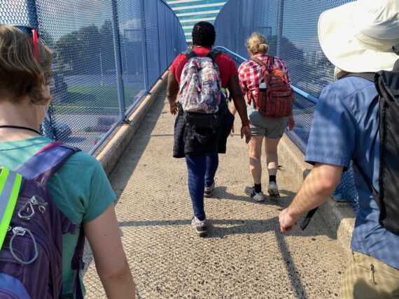
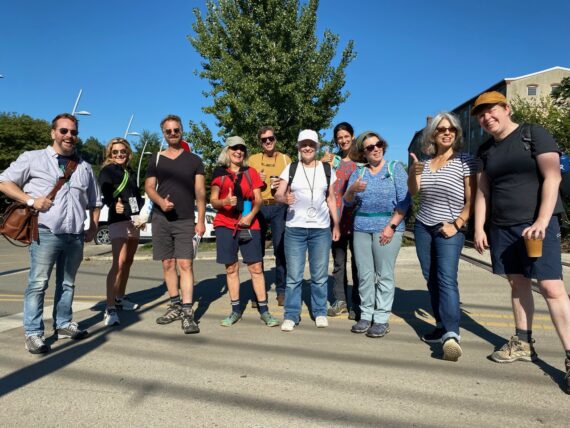
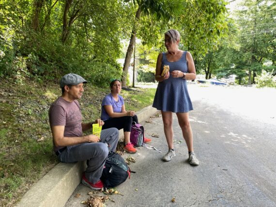
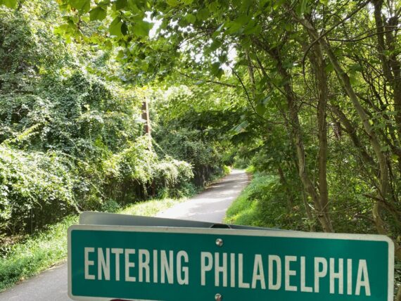
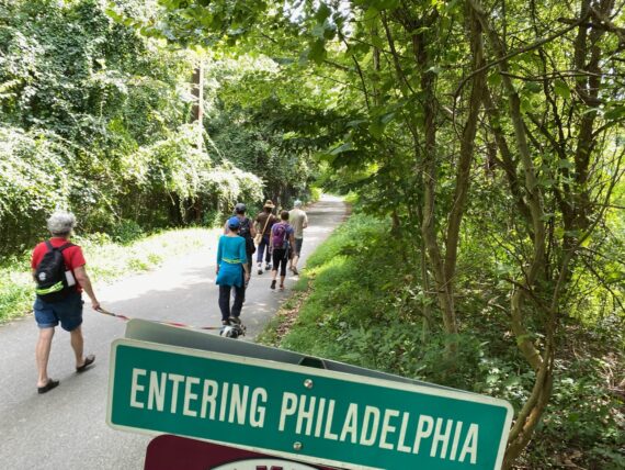
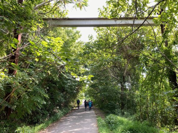
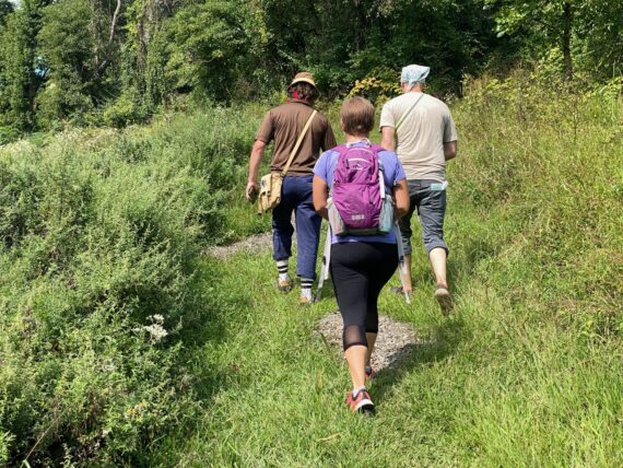
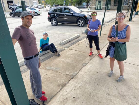
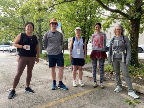
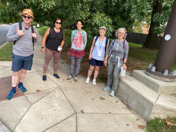
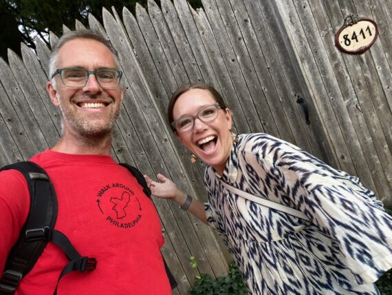
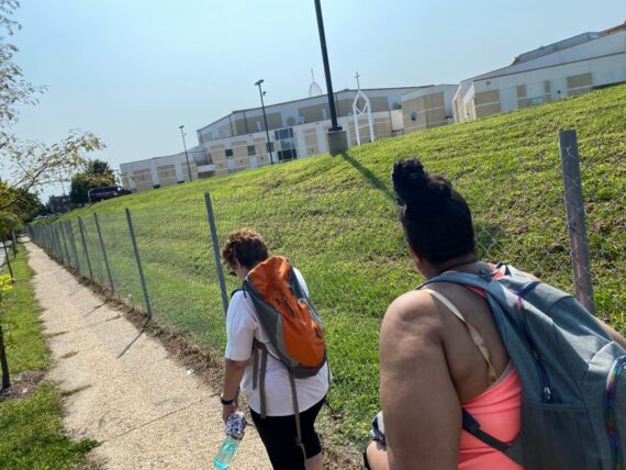
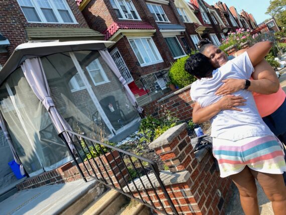
At any rate, here was our first group, ready to set out up Cobbs Creek Park northward from our starting point at 61st St & Baltimore Ave.
(I’d joked to the WHYY reporter that Walk Around Philadelphia is the least efficient way to get from the north side of 61st & Baltimore… an endeavor that could take either ten seconds, or ten days, depending on which way you go. But this is about a different kind of efficiency…)
Of course I really wanted to walk the whole way with these kind humans, but I knew that I’d only accompany them part of the way before sending them off on their adventure and backtracking to meet the 2nd group for our later start time.
(Every iteration of the walk has had new experimentations in format – last year’s pandemic version sent everyone off in an “organize your own pod and choose your own adventure” way, whereas for this one I’m bringing groups together, getting them oriented, and sending them off to explore on their own.)
Each group has or two ‘veteran’ perimeter-walkers who’re already experienced with the project, but there are no hierarchies here – the group co-creates their route through the choices that they make together as they try to stay as close to the perimeter as possible.
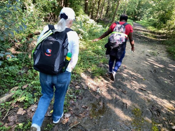
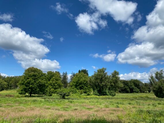
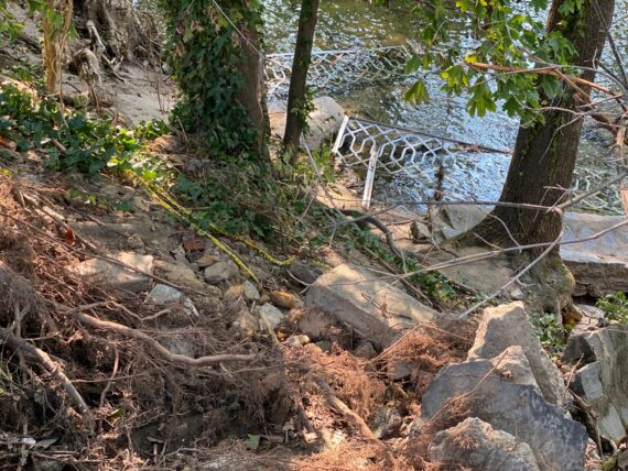
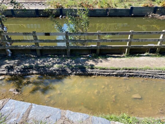
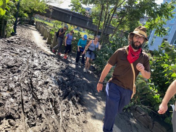
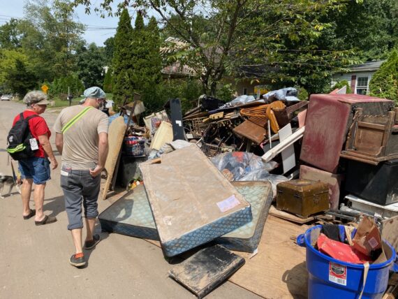
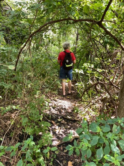
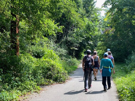
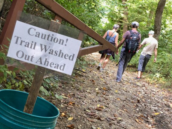
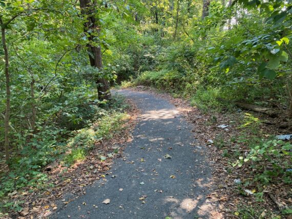
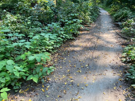
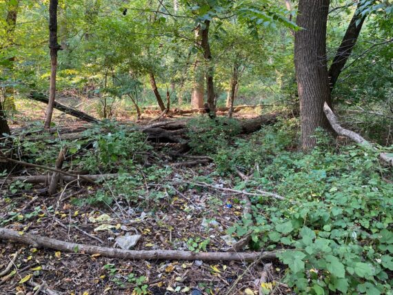
Moving upwards along the trail through some beautiful woods, we quickly encountered some pretty muddy terrain…
(In the aftermath of recent flooding, I was particularly curious what we’d encounter the next day as the second segment would take walkers through heavily impacted Manayunk.)
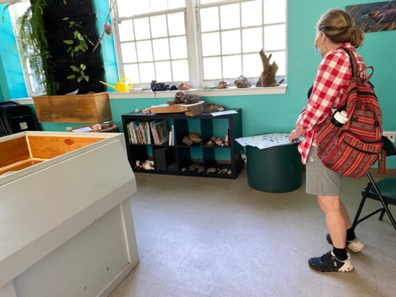
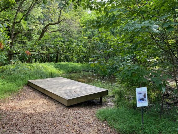
… and found ourselves at the Cobbs Creek Environmental Center, where staff there welcomed us and told us both about the center’s offerings and experience of creek flooding there…
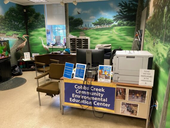
Visiting the environmental center was a first for me. This is my 8th time around the city’s edge and walking by it, but it was my first time actually going inside. But that’s the way it goes with the walk… there’s always something new to discover…
(This past February we were just ~10 mins into the walk before we encountered that broken-into safe in the woods)
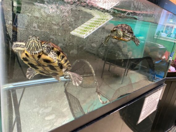
The Environmental Center has some turtle friends to meet… and also conveniently happens to have…
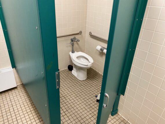
… some publicly accessible restrooms in good working order, which are always a gift on this particular adventure.
(Yes, the walk FAQ do warn participants that one might have to be ready to poop in the woods, but it’s nice certainly nice to have access to facilities like these…)
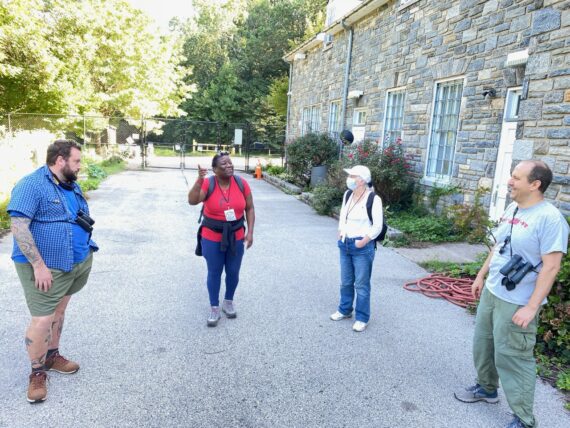
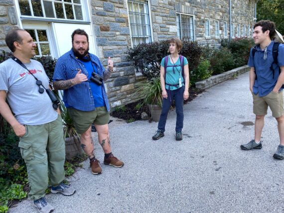
After sharing some more time and stories with Tony & Billy (who were struck by the idea of the walk and immediately started brainstorming potential partnerships with the Parks & Rec dept & ways to help get young folk involved with it… ) it was time to get moving again…
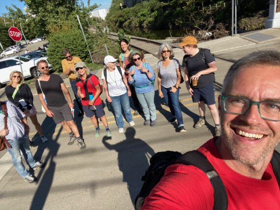
… I bid our first group farewell, and doubled back for the 10:30am departure.
Now here’s a dilemma with this format of offering two start times: as of the early morning, exactly zero people had registered for the second group, so I could have conceivably just kept walking with the first group.
But since it’s offered through the Fringe and conceivably someone might show up at the last minute as a “walk up ticket”, I had to be there no matter what, and was prepared to do today’s segment solo.
(I did the whole walk solo for the most part in 2017, and have done several other segments solo in subsequent years, and that’s a great way to experience the perimeter too, although brings up other questions of safety, access, privilege, etc…)
But as I headed back I saw the ticket report that there was indeed someone who’d signed up last minute for the 10:30 “show”…
(it still feels kind of funny to use theater/performance language for this experience… )
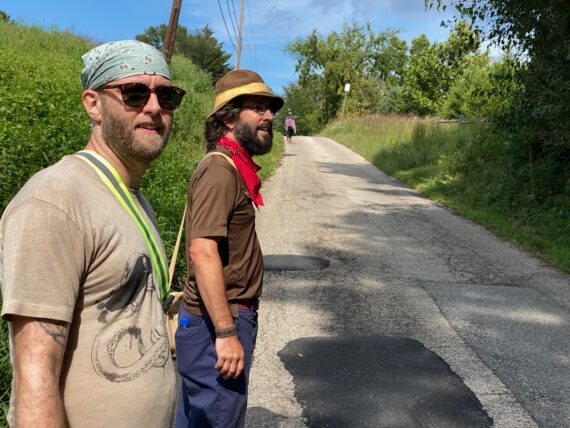
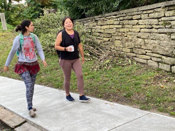
… and so I was delighted to find Jane back at the beginning as we set our way back up the Cobbs Creek trail…
… and right back to the environmental center…
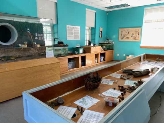
… where I got a better look at the classrooms…
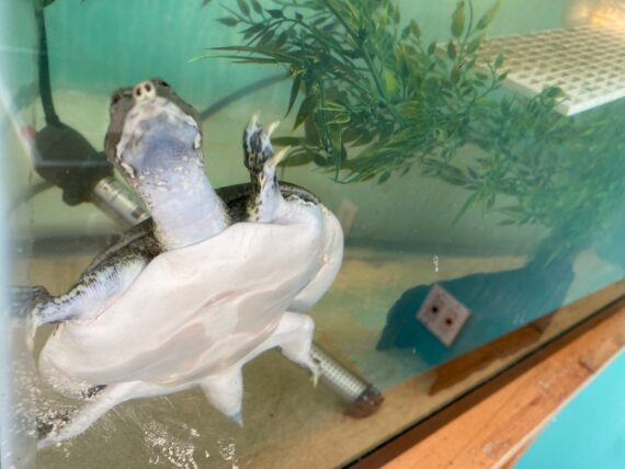
… and recognized a softshell turtle…
(Amazing how some reptile knowledge learned when I was ~15 yrs old is still lurking in the depths of my brain…)
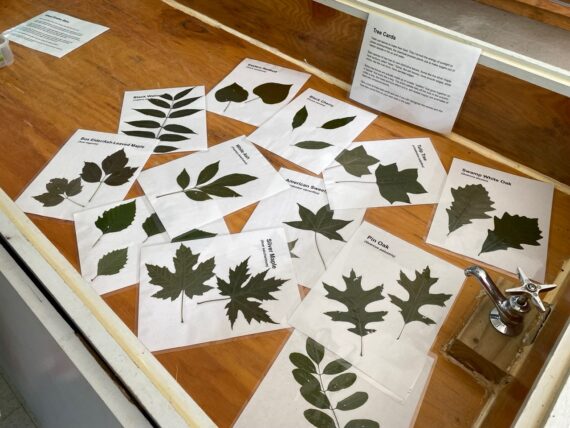
We also found some tree identification sheets that would have been useful for group 1, where someone had been asking about types of trees…
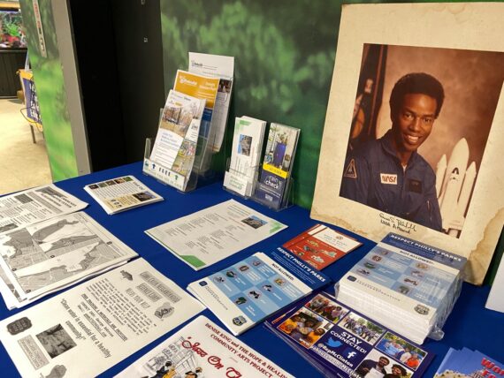
I was also surprised to spot this portrait of NASA astronaut Guion Bluford which might possibly have been a print from my dad’s archives of space junk…
This Philadelphia native who was the first African American to go to space is a familiar face and I’d set aside several prints of him from my dad’s collection for my housemate who passed them on to a W. Philly community group who was doing a project about him… was this one of those prints? It’s a NASA stock photo, and looks so familiar but it could also have come from another source…)
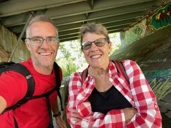
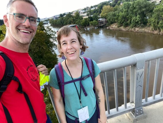
At any rate, Jane and I set back off through the woods and soon enough came to the underpass at Marshall Rd where we had an opportunity to take a ‘bridge selfie’
(a Walk Around Philadelphia tradition has been to take selfies when going over or under a bridge…)
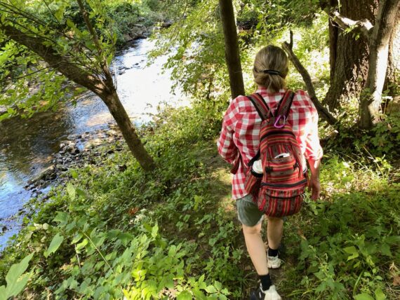
Jane’s an experienced hiker and so led us down along the tricky terrain close to the creek…
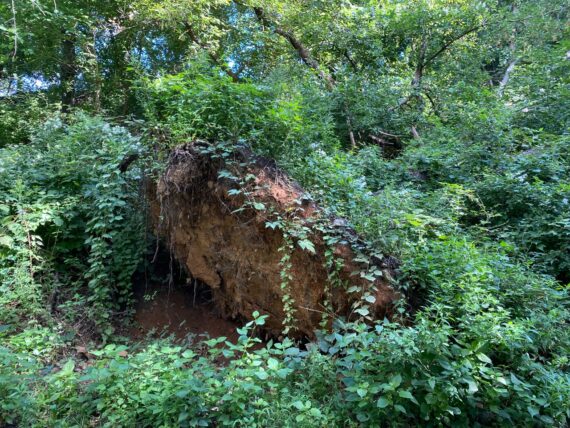
… and we saw some signs of recent storms in the form of uprooted trees…
… before finding our way out onto this strange landscape…
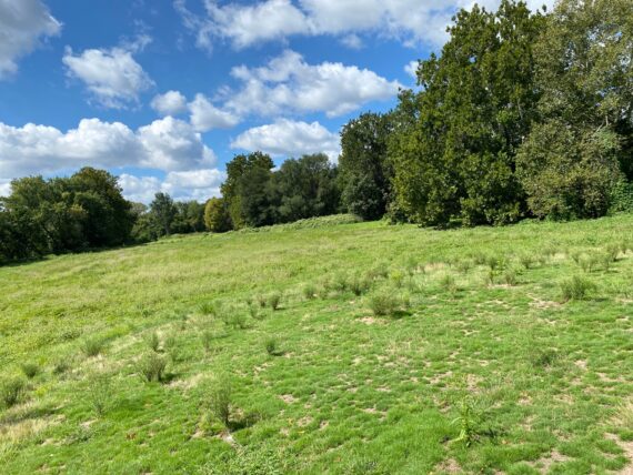
I realized here why I hadn’t recognized this location at all in the photos from the recent Walk Around Philadelphia retreat that I’d facilitated for the University of Pennsylvania’s SNF Paideia Program:
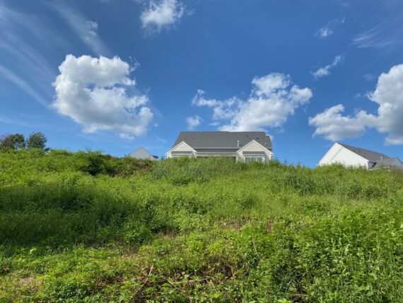
What I knew as a neatly manicured golf course here was now unkempt, beginning to grow wild into a meadow…
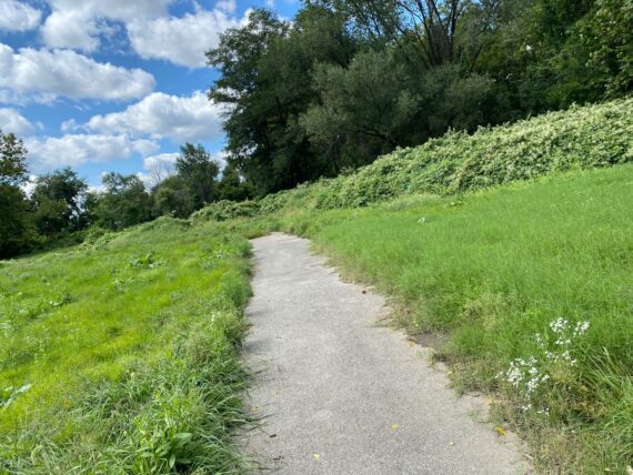
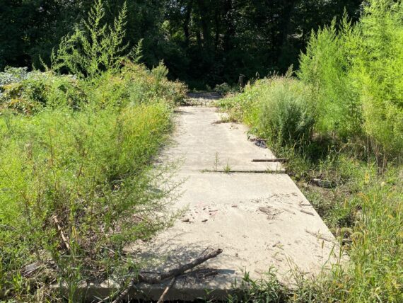
It took a while of tromping through the high grasses before being able to find the paved path…
… which led us to the barely-visible bridge over the creek.
(The very same bridge where the practice of ‘bridge selfies’ first began when Adrienne Mackey, Sam Wend, Ann de Forest & I first set out to explore the perimeter in 2016.)
The overgrown golf courses provided one of the first expanses of vast space that we’d encounter on the perimeter (there are many more) and I was delighted to see tons of dragonflies here.
(Group 1 apparently saw several hawks here too!)
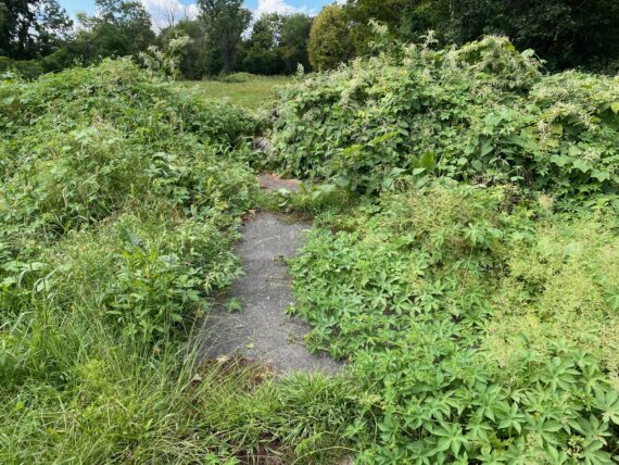
The footpath closer to the perimeter was overgrown, so we took this patch of road closer to the golf course facilities (again, there’s no fixed route to this adventure – each time is a completely different walk…)
In the next segment of golf course, we crossed this little bridge across the creek…
(technically putting us, for a short stint, into the land of “Not-Philadelphia” – which here is Upper Darby)
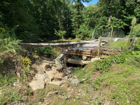
… and there next little bridge back across into the Philly side of the creek showed significant damage from the recent flooding.
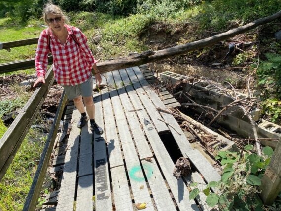
We cautiously made our way across the damaged bridge…
(When walking, remember the “Roomba Rule” – you can always find your way past any obstacle or area that feels unsafe by simply going around it. In this case we could have just as well backtracked and gone back across the first bridge and that would have been great too!)
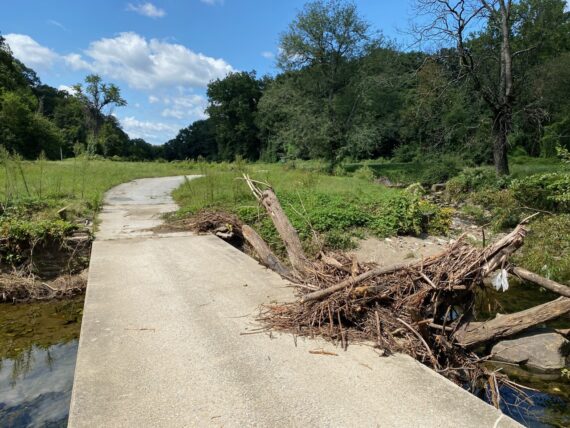
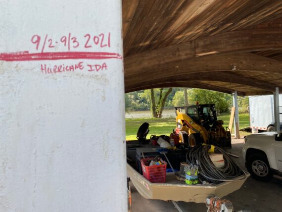
Further on ahead, there was more evidence that heavy rains from hurricane Ida had brought lots of water through here…
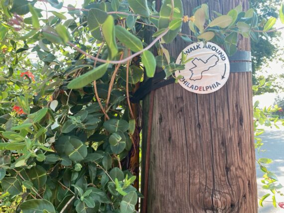
… and we found a trace that earlier perimeter-walkers had been through here…
(The stickers serve both as trail-blazes / way markers and invitations into the project and the high school students who walked the whole perimeter last year really enjoyed slapping them wherever they encountered them… like a ‘high five’ across time with fellow walkers who have come before you or will come after you…
I encourage participants to be thoughtful in where they leave them and this one felt perhaps a little bit -too- bold, right on the middle of the golf course’s little structure, whereas I might tend to put them on posts & more out of the way structures…)
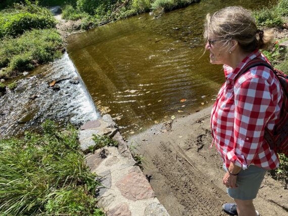
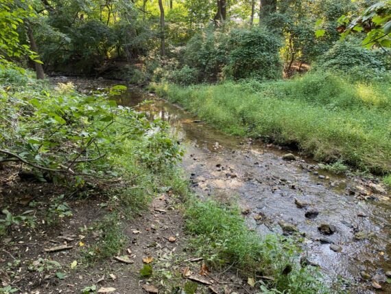
Knowing that we’d be soon coming out of this first peaceful green segment of the perimeter onto the hustle & bustle of City Ave, we took a moment to stop and listen to the trickling water…
As we came by the shut-down driving range…
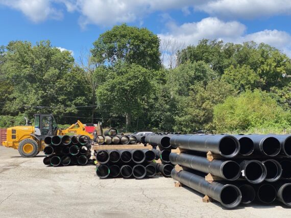
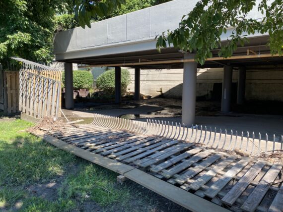
… we encountered the first signs of active construction, where some major water infrastructure work was underway…
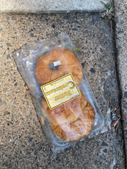
Once we made it across City Ave and onto the sidewalk there, one of the first sights was this random set of croissants lying out there…
Turns out that Elizabeth in the group ahead of us had texted me a photo of these very same croissants, and so this felt like not just a landmark but an invitation or a dare…
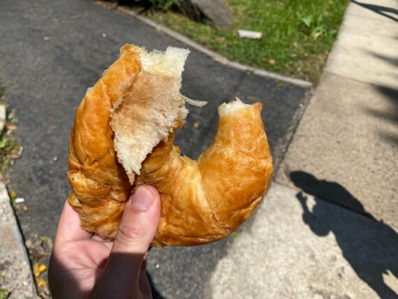
… and so of course I pulled them open and sent a few pictures back to Elizabeth, both to let them know where we were in relation to them…
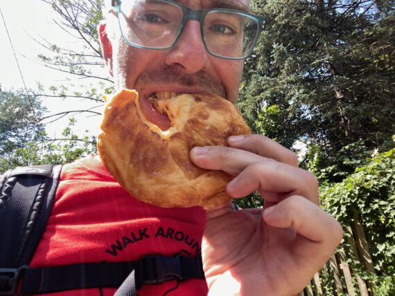
… and to let them know that the challenge had been accepted.
(This is also for fellow perimeter walker Liana, who joined us in the walk in Feb 2020, and also “appreciated” my tendency to want to try every bit of random edible thing found by the side of the road…)
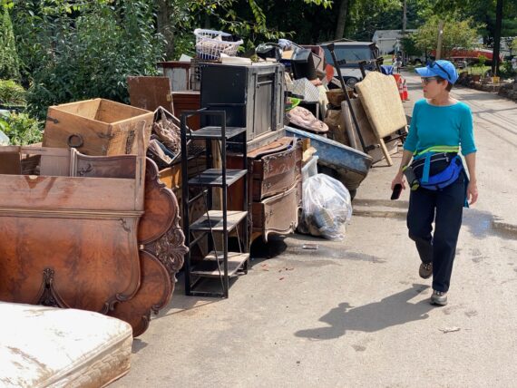
I didn’t take many snapshots on City Ave, which was mostly unchanged since my last pass… but it was still a completely different perspective to walk a chunk of it on the left (Wynnewood) side.
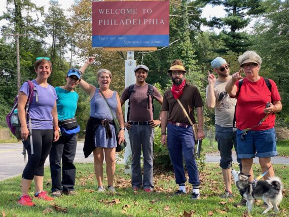
Our exchanges over the croissant had made it clear that despite setting out 2hrs later, group 2 had almost caught up with group 1, so they waited around for us a few minutes around St. Joe’s campus and we intercepted them!
(It turns out that Jane & I had been walking faster than they had, and they’d taken some more winding paths through the meadows & bathroom breaks in grocery stores… the paths and paces are always variable, so all mileage and timing in the walk are just estimates!)
One of the members of group 1 had peeled off, as they felt like they’d hit their walking limit for the day, so it was easy to combine our two small groups…
(It’s important to listen to one’s body and one can always stop at any point and resume a segment whenever one likes…)
With our groups thus merged, we thus set off down City Ave, where we encountered one of our first…

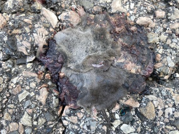
… dead things, in the form of this quasi-mummified squirrel that Rocky spotted.
(Rocky, who also walked the whole perimeter this past February, knows that I have another friend who’s fascinated by dead things, and that I often send her images of roadkill and the like from the perimeter…)
Walking the city’s edge offers many opportunities to encounter death, and this is another one of the rich parts of this experience where we encounter so many facets of life that we are rarely in contact with and help us gain a deeper appreciation of the complexity of our existence…
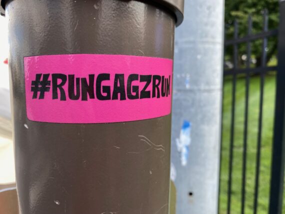
Another newer sight around the perimeter are these little stickers left behind by ultra-marathoner Michael “Gagz” Gagliardi, who ran the whole perimeter in a day last year. I helped him plan his route, and then he later interviewed me for this podcast episode.
When I tell fellow walkers that he ran the whole thing in a day, they are without fail astounded.
(Gagz’ route came in around 76 miles, whereas our ways winding back and forth closer to the city’s edge can take anywhere from 97 to 120 miles…)
After conferring with our fellow walkers, we decide that we’re going to try for the City Ave bridge crossing, so we cross to the north side…
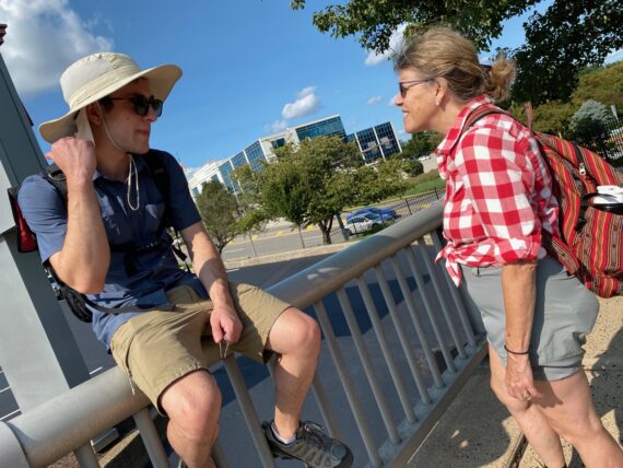
… but this experience isn’t just about the sights and the logistics, it’s about the conversations that happen along the way…
… and the fellowship and bonds that come from setting out on this experience together.
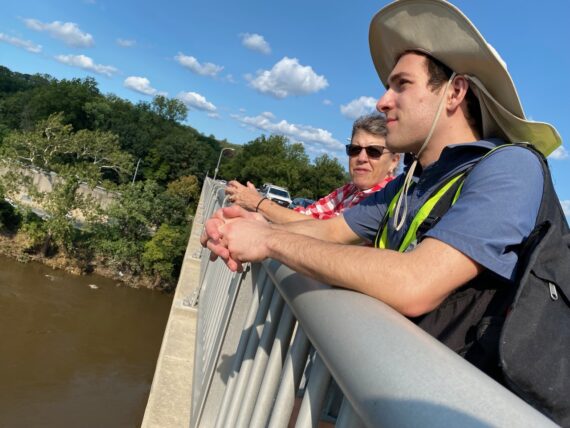
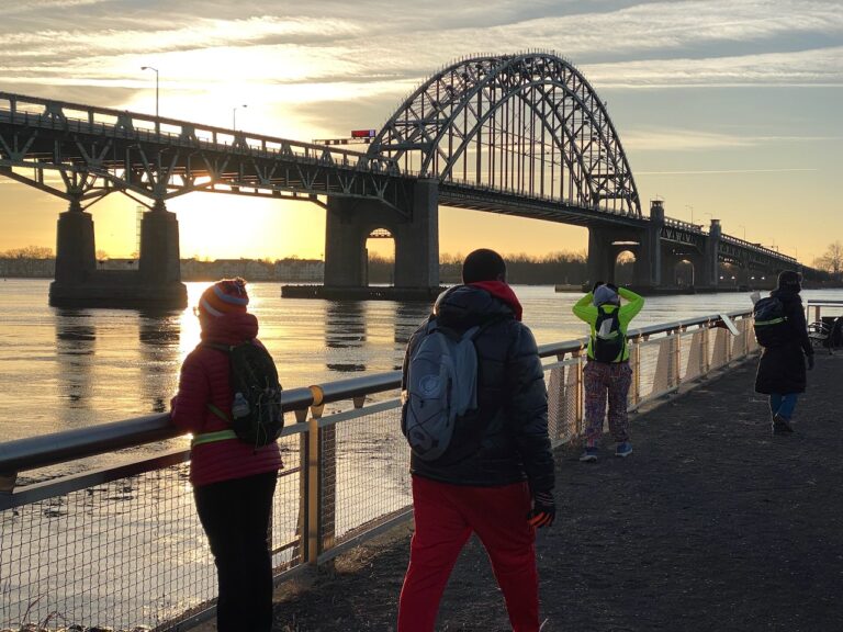
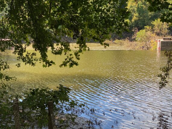
Once on the City Ave bridge, we took a moment to take in the view over the river…
(the water level still looked quite high in the aftermath of hurricane Ida…)
Naima’s quoted in the WHYY story observing how the pace of walking allows for more observation and noticing, whereas when you drive through somewhere you don’t really see it…
For example, how many humans pass over this bridge every day…
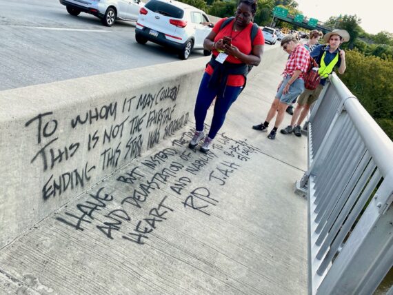
… without any of them ever noticing this message…
… and of course I wouldn’t recommend the practice of taking bridge selfies while driving!
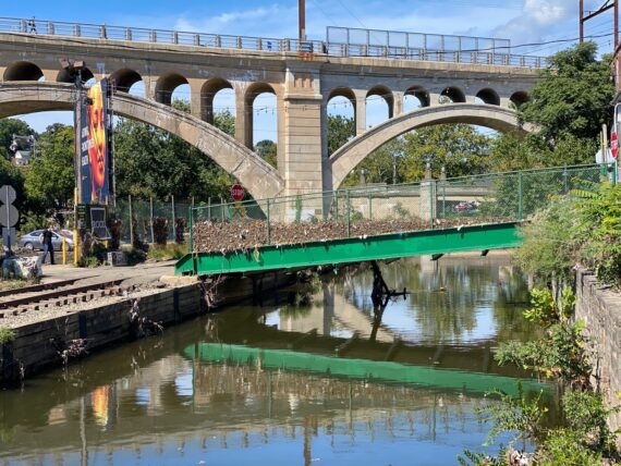
Once across the bridge, we were almost at our target end point of the Wissahickon regional rail station!
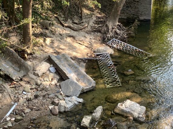
As we approached the crossing over the Wissahickon creek, we looked down and saw…
…. some big segments of fence in the water…
and then we looked up ahead…
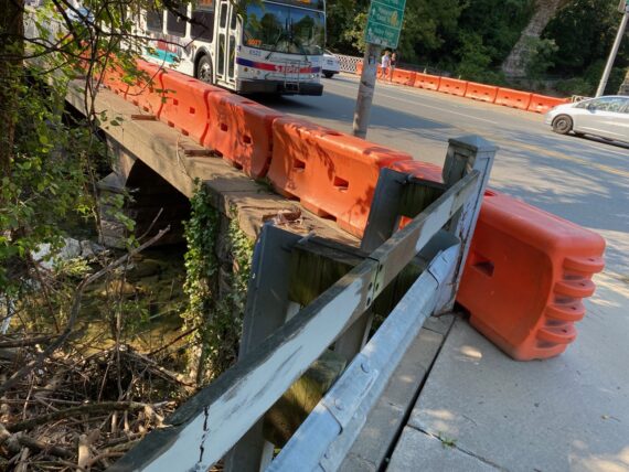
… and realized that they must have come from the bridge just ahead, where these temporary barriers had been erected.
How wild to look down on these once-sturdy railings…
… and to realize that the water had flooded up above the level of these falls…
(yes, also that’s a big bird… maybe a crane? We also saw blue herons & a green egret on this day!)
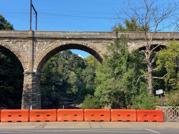
… and how much force required to rip away these railings rather than just flow through them?
At this point, we’d reached our target destination for the day.
We bid farewell to Naima, (who was amazingly enough facilitating *another walk* that evening with We Walk PHL) and the rest of us opted to continue on a bit further up the perimeter to take in the flood impacts in Manayunk (and hopefully end the day with an ice cream treat…)
As we made our way along Main Street, the walking pace allowed us to notice how much mud there was up on what seemed like high-enough ground… and then the leaves stuck in the fence made it clear how high the flood had crested…
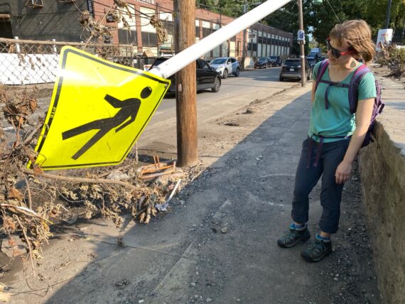
There were knocked down signs…
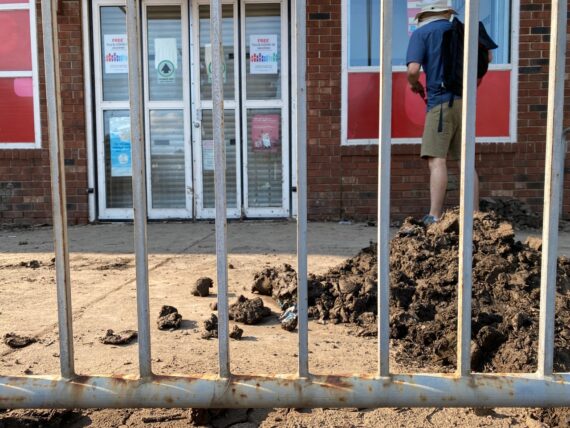
… and the convenience store / pharmacy that was a great bathroom break spot on the first walk was closed with dumpsters and a pile of mud outside.
As we approached and peered in the window, we found…
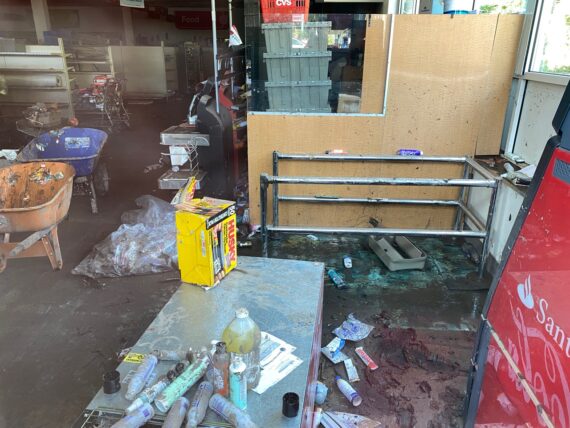
… a gutted store, with bare shelves, floors covered with mud, and wheelbarrows and trash bags showing signs of the beginnings of a clean-up effort.
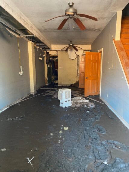
Further along Main St, another glimpse into a (previously condemned) residential space, with the floor coated with mud…
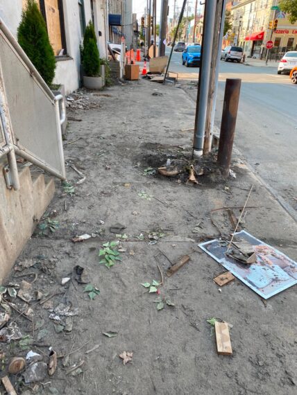
… and sidewalks coated in dirt…
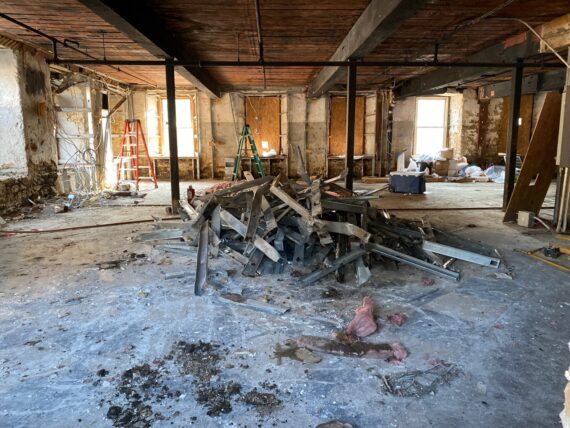
… and retail spaces completely gutted…
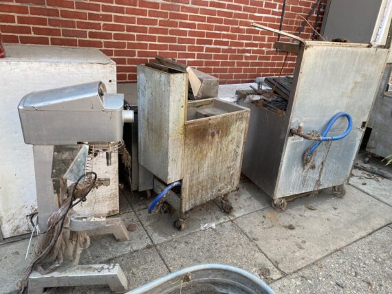
… and a brew-pub’s entire set of industrial kitchen appliances lining the sidewalk…
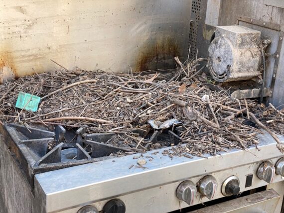
It was wild to see this stove, that was probably the very same one that had helped feed us during a lunch break on a previous walk, covered in twigs and detritus…
… and the oven itself completely filled with mud.
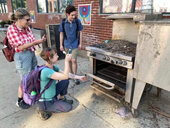
We weren’t here for disaster tourism though.. our goal is simply to follow the city’s perimeter, and see what we encounter. But this was definitely different than every other time I’ve walked this stretch of the border.
This experience definitely brings up questions about climate change, disaster-preparedness and community resilience…
So that brings us to the end of the first segment – already a lot for the first 10 miles!
We were joined at the end of this day by veteran perimeter-walker Greg, who’d also walked the whole thing through snow and ice in February.
In the first of what I hope will be many more “trail-angel” type scenarios, Greg had sent me a well-timed message asking how day 1 had gone, saying that he was picking up a rental car on City Ave and offering rides to anyone who might need one…
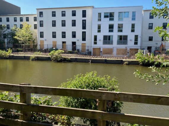
… and so after a quick glance at the fenced-off and mud-filled canal trail…
… those of us heading back to W. Philly caught our ride home. (Thanks Greg!)
In general, I advocate public transit to and from the perimeter start & stop points. But what a gift to have a friend-of-the-walk pick us up!
As I continue to to build ways to facilitate access to this unique experience, I’ll be looking for partners along the perimeter (businesses, congregations and also individuals living on or near the perimeter) who can be resources to walkers. If you know of a good fit, send them my way!
Segment 2:
Wissahickon Station towards Chestnut Hill East
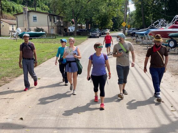
The following morning, I found myself heading out early on regional rail with Hanna & Ann – Hanna’s done a few prior segments of the perimeter (in Feb & Sept 2020) and Ann is the artist that I was paired with in the artist residency that led to the first Walk Around Philadelphia in 2016.
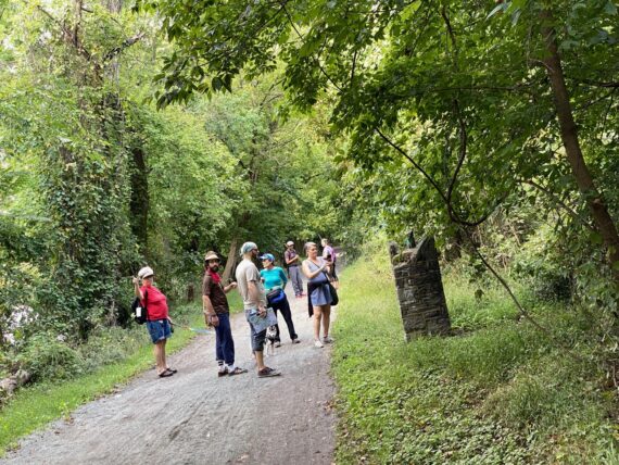
Today’s group was larger (10 total), and we started off gathering ’round the map at the Wissahickon regional rail station.
After a quick ’round of check-ins and introductions, we were ready to head out…
(Someone asked if anyone had any extra sunscreen, and another walker offered that there was a drugstore a little ways away that would have some… but of course based on my bonus walk the day before, I knew that that flood-shattered store wouldn’t be in any shape to offer sunscreen for quite some time…)
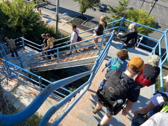
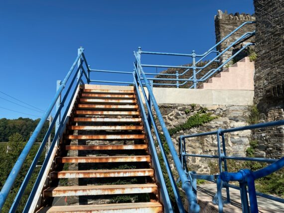
… into what was already new territory for me, for as many times as I’ve walked the Manayunk section of the perimeter, I’d never walked down these stairs.
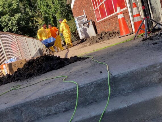
Sure enough, while work had resumed at the drugstore, it wasn’t selling sunscreen, but rather more muck-shoveling with wheelbarrows…
A coffeeshop a little bit further ahead was on higher ground had been spared from the flood damage, and provided a first opportunity for a bathroom break. Already, connections & conversations were starting…
Mimi who’d had to peel off early the prior day had re-joined for the second day of the walk, and pointed out the high-water marks along the canal trail…
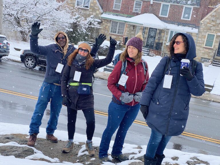
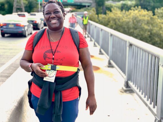
I was delighted that this crew included both native Philadelphians, visitors from Ocean City & California, and a relatively new transplant to Philly (welcome Logan!)
(You’ll notice from this pic that participation in the walk tends to skew to a whiter audience, and isn’t representative of the city’s demographics. There’s a host of reasons for this, and my goal is to continue to cultivate partnerships and accessibility initiatives such that the walk easier to participate in for all sorts of Philadelphians by it’s 10yr anniversary in 2025. Again, I’d welcome your support in continuing to develop this project .)
Again, I found myself torn as I would have loved to continue walking with this group, but it was time to backtrack to prepare to meet the second group. I made sure that group 1 was well oriented with all questions answered, and headed right back to the regional rail station…
… getting to appreciate those fabulous stairs one more time…
… to join group 2!
(Yes, that is a super sweet pup joining us there, and no, you’re not supposed to bring dogs on the walk. While I loved this pup, it did cause problems for us at one point, and there’s several reasons why I ask that you refrain from bringing your dog friends on the walk.)
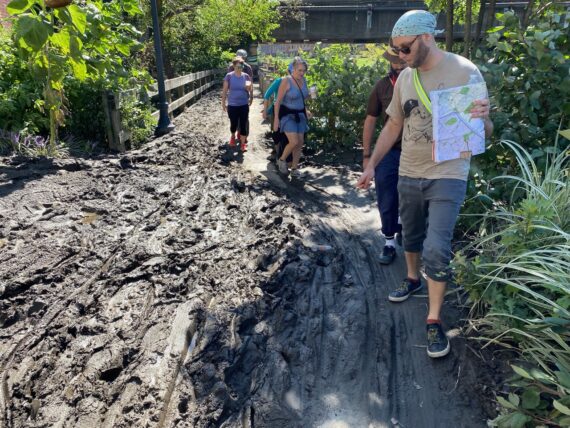
And so here we go again, for my third time in 24hrs walking up Main St Manayunk…
(but of course a first time seeing this flood damage for most of our walkers…)
The contrasts were surreal, as some folks were out enjoying brunch or their morning bike ride, while others wearing hazmat suits were at work cleaning up the flood damage nearby.
The canal trail was still closed here, but if you look closely at the green bridge, you can see all of the leaves and debris trapped in the fence which show how high the water had risen…
… and further ahead I understood why the trail had been closed – here a whole chunk of it had been eroded away and was still full of water…
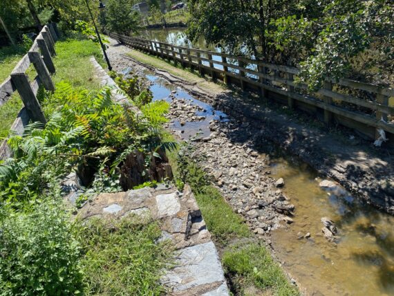
… and there were actually fish trapped swimming in these puddles on the canal trail!
Further upstream, we were able to get on the trail, where we found…
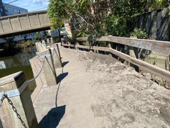
… lots of dirt piled up on the boardwalk…
… some serious amounts of mud!
We strode on…
… noticing buildings with boarded up ground floors so close to the canal…
… and large fences torn down…
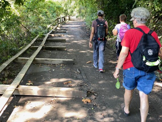
… including large segments of the trail’s railing.
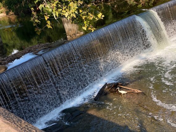
At the Flat Rock Dam, the overflow spillway which is usually dry showed that the water level was still pretty high…
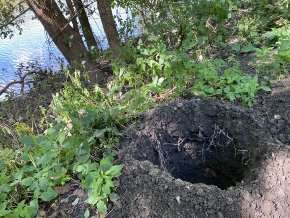
… and while the first of these large holes confused us for a second…
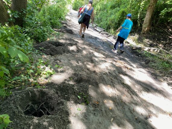
… we realized that the regularly spaced holes were part of the already-underway repairs for rebuilding the damaged fence.
As we stopped to contemplate the dam itself…
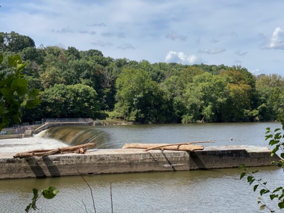
… we saw the many logs left behind on top of it, again showing how high the water had been.
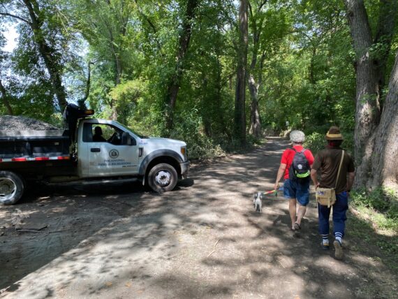
We passed some city workers with a truck-full of gravel at work on trail restoration…
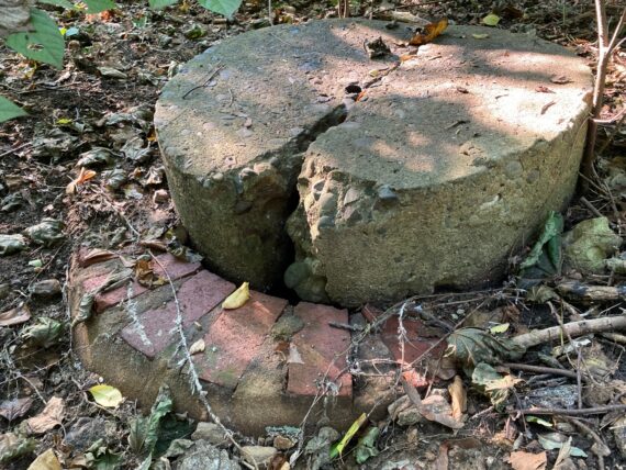
… and I led our group on a tiny sightseeing detour off of the main trail…
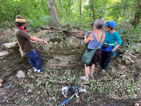
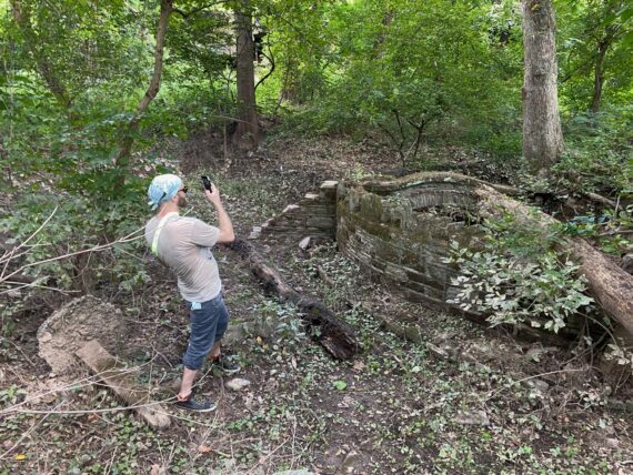
… where we stopped to check out this strange little stone structure in the woods.
(If anyone knows the history of this strange ornamental structure, please let me know!)
One last snapshot before heading on along the Schuylkill River Trail…
… where we took in the sights of some other ruins… there was definitely some interesting activity along this stretch of the river in the past.
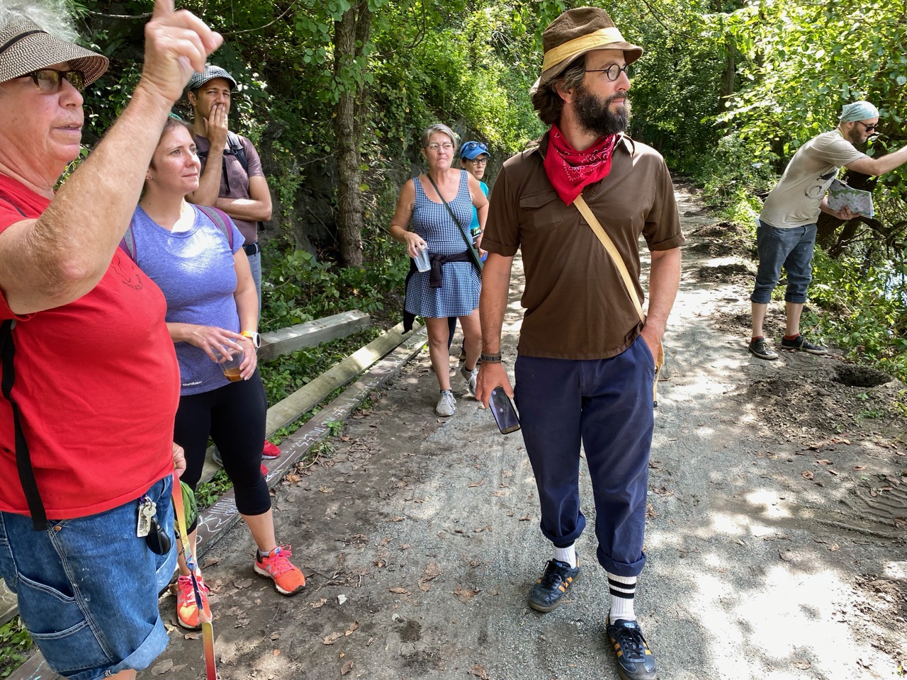
We discussed our options up ahead, as the perimeter makes a 90 degree turn up a steep incline into Chestnut Hill, and it’s hard to follow it directly.
Eventually our group decided that we wanted to hug as close to the perimeter as possible all the way up towards Miquon in order to see how the floods had impacted River Road, and then double back on the bike path to then head up the hill via the trails in the Schuylkill Center for Environmental Education.
(To find out which path Group 1 took from the river up into Chestnut Hill, register for the virtual reportback at 7pm on Sunday October 3rd via zoom!)
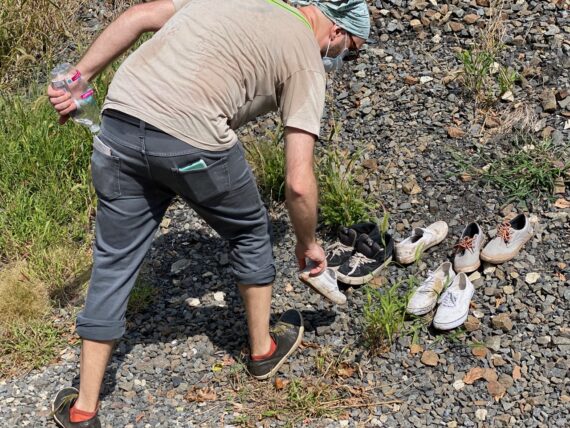
Nick took a moment to investigate this random collection of shoes by the side of the rail track… but they weren’t his size.
As we head down into River Road (the mysterious tiny little one-street wide river community at the northern edge of the Schuylkill River segment of the perimeter) we first encountered some of the quirky character of this area…
(yes, that does seem to be a tanning bed back there under the tent.)
… we quickly realized that the area had been hit hard by the recent flooding.
Nick there is 6′ tall, and that high water mark is definitely at least a foot above his head…
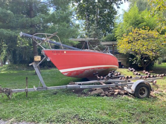
… and once a boat this size gets knocked off of its trailer, it takes some pretty specialized (and presumably costly) equipment to hoist it back up.
Further on ahead, we began to see the contents of homes out on the street…
… this was particularly heartbreaking.
We continued on up the last stretch of River Road…
… past a tattered flag…
… and the remnants of some jewelry strewn in the street…
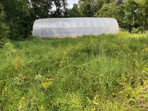
.. before stopping for a lunch break just outside of Philadelphia, near the AIM Academy.
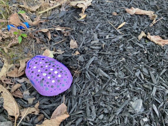
Pausing here allowed us to notice a series of tiny painted rocks tucked away all over… presumably a project by some of the young people at the school or one of the summer camps that operates there.
There were also larger changes here, like this bicycle repair oriented facility that I hadn’t seen before. A quick bit of googling reveals that it was created in memory of Samuel Ozer, a young man who’d recently graduated from AIM Academy when his life came to a close in a tragic bicycle adventure.
As we backtracked along the bicycle trail (higher above River Road) and hit the actual perimeter border…
Judi thought that she saw a a trail close to what would be the actual perimeter and went off to explore, only to find that it was too overgrown…
… and so we continued on back into Philadelphia.
As we followed this paved trail doing our best to stay out of the way of bikes whizzing by…
… I found myself looking up at this solitary steel girder and thinking that it would make a great place to rig for an aerial performance by my friends at Tangle Movement Arts or the good folks at the Philadelphia School of Circus Arts… but that’s just because I like to climb on things…
… and it was time for us to start climbing uphill!
The Schulkill Center for Environmental Education has a great set of interweaving trails through the woods, and we tried to figure out which one to take to keep us going along the perimeter…
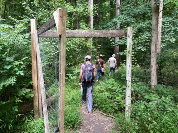
… and so we found or way through the deer-exclusion gate and into some welcome shade…
Taking this path led me to some corners of the Schuylkill Center that I hadn’t seen before…
… like behind this greenhouse…
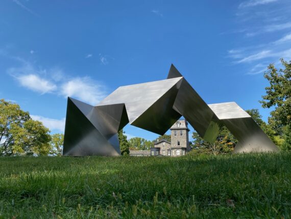
… and by these sculptures…
… until we found ourselves at the main buildings…
… where they have a gorgeous gallery space…
… and a beautiful, sun-lit space for educational programs…
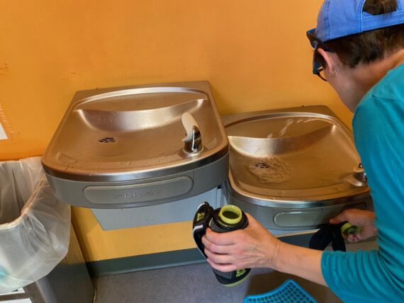
… and good news for perimeter walkers: water fountains and bathrooms!
There’s so much to see at the Schuylkill Center, but between the fact that they have a no-dogs policy (again, please do not bring your pup friends on the group walks…) and that they were about to do a special program for the 20th anniversary of the September 11th attacks, so we kept on moving…
As we found our way towards Hagy’s Mill Road…
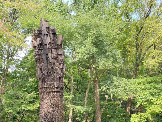
… we stopped to admire this creative deconstructed tree-trunk sculpture on the Schuylkill Center grounds…
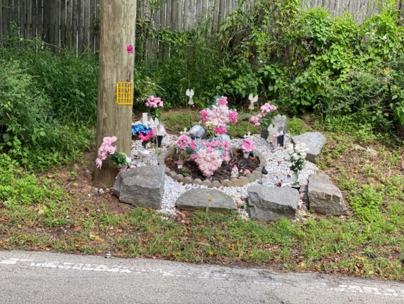
… and then this sadder installation, presumably in memory of a car crash victim…
After a brief stint along Ridge Ave, we found ourselves on Northwestern Ave, which put us back directly on the perimeter…
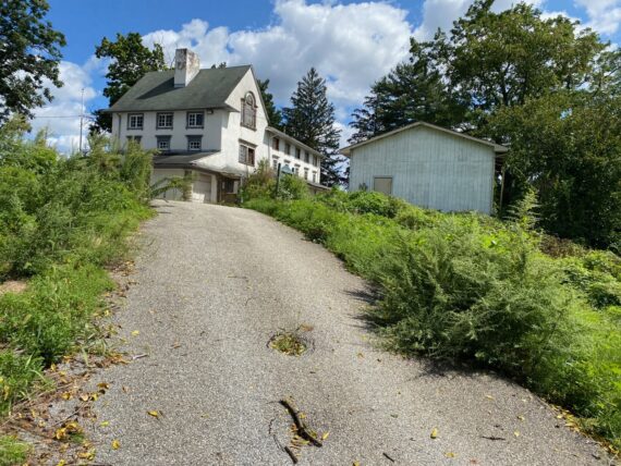
… where over the hill I saw the big new houses (not in Philadelphia) that I’ve been watching be developed as I’ve passed by each year on this strange pilgrimage tradition.
While at my feet….
… was another dead thing for me to send to my friend Meagan, this time a tiny mole.
(The regular encounters with death on the perimeter are a good opportunity to confront our own fragility and mortality and maybe thus better appreciate the simple gifts that are each day that we’re able to be here participating in the world…)
I didn’t understand why this road was closed, but it didn’t impact us, as that road leads out of Philadelphia, and we could still continue directly on the perimeter a little bit further on Northwestern Ave…
… until our friends ahead realized that the road beyond becomes a private driveway with a fence and gate…
Conveniently there was a trail right there that lead us along the perimeter at the very northwestern edge of the Wissahickon Valley park…
… although that trail too had clearly been impacted by recent storms…
Once we made it to Germantown Ave, some members of our crew were crunched for time.
We split up here, with three hopping in an rideshare car to get back to where they’d left vehicles at the start point, and the rest of us heading down Germantown Ave to get to the Chestnut Hill East station.
We were technically cutting a corner here, into Philadelphia proper and missing the top of Morris Arboretum where Northwestern hits Stenton, but that’s ok!
Taking that path allowed us to walk by the Woodmere Art Museum…
(Yes, that same Woodmere that included the animated recap of the first Walk Around Philadelphia alongside one of my photographs from Shale Gas Outrage in their 2018/2019 exhibit “The Pennsylvania Landscape in Impressionism and Contemporary Art”)
… before finally making it to the Chestnut Hill East station…
… for a relaxed ride home.
(Note: there are abundant transit options all along the perimeter, which make it fairly straightforward to plan route segments with options to get home / resume later from most anywhere along the city’s edge… thank you SEPTA!)
Segment 3:
Chestnut Hill East towards Fox Chase
Note that I’m using the word “towards” when referencing these segments for the Fringe Festival routes… the start points are fixed, but the end points are optional goals… you can stop early as your body & schedule require, or press on further if you’ve the time and energy for it, as you see fit!
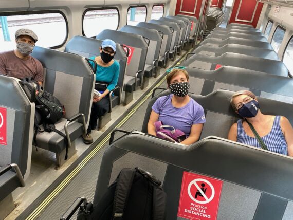
My third day of the walk started with an unexpected glimpse of City Hall – I’d gotten distracted by a message on my phone (maybe you’re familiar with this phenomenon?) and missed the trolley stop for 30th St and found myself hopping off at 15th St…
… in order to catch the train back to Chestnut Hill East from Suburban Station.
(I always try to plan in extra time to be early for these trips…)
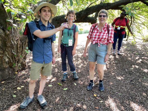
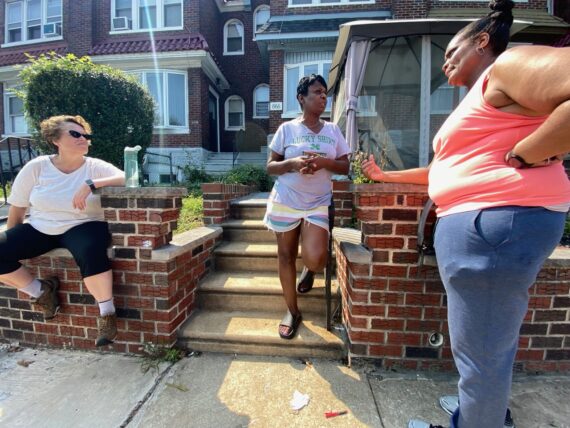
Here’s our first group to depart for this segment. Hanna hadn’t meant to come this day, but decided to come back after having had such a good time with the prior day’s walk.
Since Mimi was back for her 3rd day walking, and Michelle & Rebecca had all done segments of the walk in prior years, that meant that Doug was the only one new to this experience in this group…
Hanna & Michelle had that immediate connection from having walked together in Feb 2020…
… and while Doug was new to the Walk Around Philadelphia experience, it turns out that he was the one who had extra helpful knowledge of the landscape at the start of this segment:
… he knew that there might be a bathroom that we could use at St. Paul’s Episcopal Church. An excellent start to the day!
I only walked a little bit up Stenton Ave before sending these kind walkers off and doubling back to receive group 2…
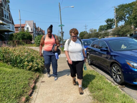
… and in this case group 2 was in fact a group of 2, as Lisa & Sharon were the only two who’d signed up for this segment. (And what a treat it was to walk with them!)
And so we made our way back out to the perimeter on Stenton ave…
… where there’s only a sidewalk on the “not Philadelphia” side, and very few pedestrians, but then suddenly this person came around the corner. While Sharon went to navigate around them, I stopped dead in my tracks…
… because I know this person, and she’s my friend Kate – and while we’re not regularly in touch, she exclaimed “My boss was just emailing me two days ago about you, and that we should do something with your walk… and here you are!” and I replied “Yes! He emailed me the other day too – and here’s the walk, this is it, that’s what we’re doing right now!”
Turns out this wouldn’t be the only bit of fortuitous timing on this iteration of the walk…
… and so we continued on along Stenton Ave, where we saw more walk stickers than pedestrians…
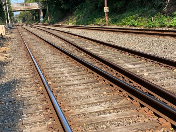
… finding our way up Ivy Hill Road, where there’s houses on the Philly side, but just these transmission lines and an old unused rail track on the “Not Philadelphia” side…
Further up Ivy Hill Rd, I was struck to see this newly completed looking building.
For the first several years of my perimeter-walking, there was a neglected shell of girders here looking like an abandoned construction site… and then this past winter there were workers actively on it and I couldn’t tell if they were continuing building or dismantling the old metal girders. Now that question is answered…
(Walking the perimeter doesn’t make you an expert on Philadelphia – if anything, can it give you a sense of how little you might know the city. Walking it once gives you familiarity with its general shape and outline, but walking it again helps you realize how much it’s constantly shifting / growing / changing / evolving / falling into disrepair / being developed / transforming… and of course that’s just the edge, and there’s over 140 square miles of city within these borders that we’re circumnavigating…)
Walking by this massive church compound on Cheltenham Ave, the structure and landscape felt unchanged… but this time one of our fellow walkers knew some folks associated with the congregation, and had attended some services there, which led to new insights and a more personal connection to this particular piece of the perimeter…
On many parts of the Cheltenham Ave border, there are sweet 2 story row homes on the Philadelphia side, sometimes facing larger shopping centers on the “Not Philadelphia” side (here, that’s Wyncote & Elkins Park, parts of Montgomery County)…
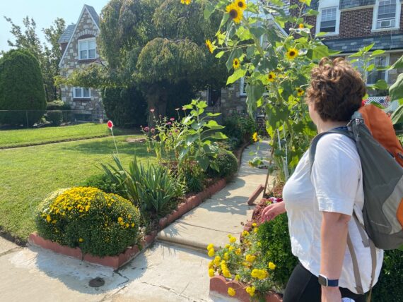
I don’t have a photograph of the kind person who tends this garden, but he was wearing a bright yellow shirt that matched his sunflowers & marigolds & whatever that other little flowering shrub is. What a colorful contrast to when I usually walk the perimeter in February!
The Cheltenham Avenue segment of the perimeter is over 4 miles long and a fairly straightforward walk down the sidewalk… you don’t really expect many surprises here…
(and yet… this is Walk Around Philadelphia, so there’s always going to be surprises…)
… and so as we trudged on down Cheltenham Ave in the hot sun, we were startled to hear a voice call out from within a little mosquito tent in front of a house to our side…
“Is that Lisa?!?”
… and what a happy reunion this was, as our fellow walker Lisa was reunited with her old friend Denise that she hadn’t seen in years and had lost touch with…
Think about all of the little bits that had to line up for this reunion to happen – Denise had just recently come out, happened to hear my voice talking w/ Sharon, looked up just in time to recognize Lisa… had we been walking on the other side of the street, or in silence, or ten minutes earlier or later, it wouldn’t have happened… but this is just another bit of perimeter magic that happens every time…
We had an opportunity to pause a while as they caught up. I learned that Denise had worked 15 years at the Detention Center prison on State Road (also on the perimeter – we’ll walk by it on segment 6 on Sept 25th…) and recently bought this house on the city’s edge.
(I asked Denise if I could follow up with her later, as I’m hoping to build connections both within the prison system on the perimeter and have dreams of facilitating the walk as part of a reentry program, and also would like to connect folks who live and/or work on the perimeter to this project…)
The conversation between Lisa & Denise surfaced somethings about Lisa’s relationship to boxing, where she’d coached some young men, and trained herself in order to find strength & power as a classical singer… and the stories kept unfolding.
Part of the walk is about learning the city, but it is also very much about learning about each other!
Continuing on down Cheltenham Ave, I noticed some of the differences that come with time of day or day of the week – for instance, I’d never seen this church’s doors open, but on this Sunday not only was it open but I could hear some lively music and make out a few figures dancing inside through the glass..
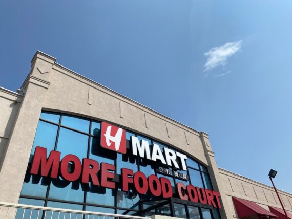
We’d made it to the H-Mart / food court, which seemed like a good place for a bathroom break & lunchtime pause…
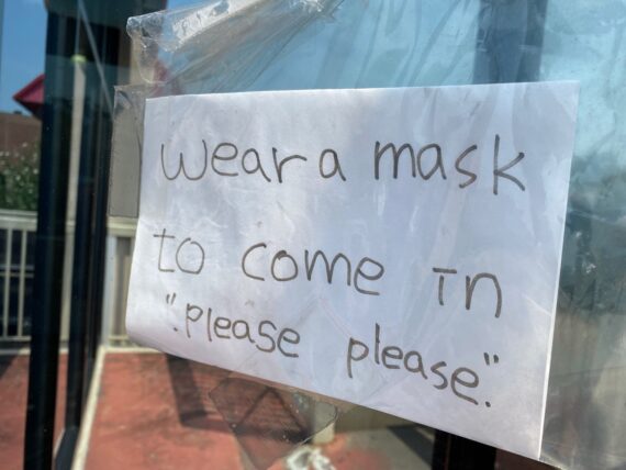
… and as we entered, I appreciated this “please please”…
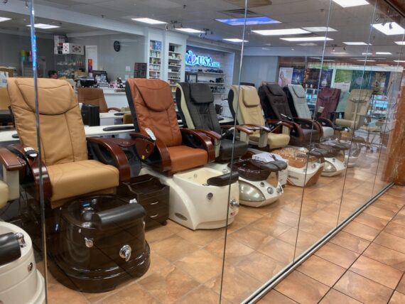
… and was sorely tempted by this store that seemed to sell spa equipment… would they let us try out the massage chairs & soak our aching feet?
(We didn’t actually ask…)
At this point we’d made it about halfway to Fox Chase, but still had a ways to go to the target destination. One of our walkers had a tweaky feeling starting in their hamstring that was getting worse, and they judged it wise to call it a day at this point.
While this route segment aimed to get to Fox Chase, the general walk guidelines state that you can start & stop wherever you’d like, and complete the walk in any number of segments however suits your needs. So this was a great choice to make – it’s always important to listen to your body’s needs!
And so I continued on down Cheltenham Ave on my own…
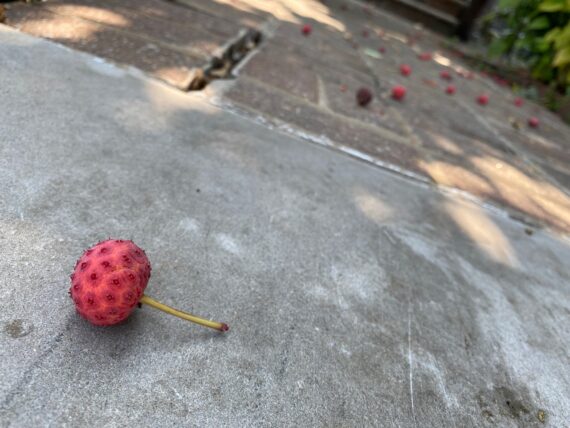
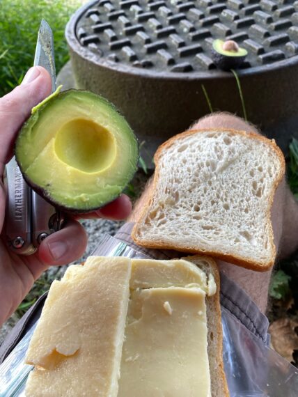
… pausing to enjoy some delicious fruit from a Kousa Dogwood Tree…
(Don’t eat the skin or the pits… my technique is to tear these open in half and slurp out the tasty insides, then spit out the seeds…)
… and as I walked by this particular strip mall (again on the Montgomery County side of the border) which houses a Korean Spa that I’d heard many good things about, I did think how nice it would be to pause here and hop in a tub or get a massage… but I pressed on…
(Did I mention that I’m now working as a Licensed Massage Therapist? (LMT# MSG013959) – and smartly I’d lined up a session with one of my colleagues for the next day…)
… admiring some more sweet gardens on the Philly side …
… before diving into Tacony Creek Park!
The effects of flooding weren’t as pronounced here… but I did see some silt on the path…
… and looking closer saw deposits on the leaves too that indicated that this too had been underwater in the recent rains…
… and I paused to send Group 1 a bridge-selfie update.
For a moment it had looked like Group 2 might catch up with Group 1 again, but after our sweet fortuitous conversation run-in and pause at H-Mart, they were well ahead of me again. And I wasn’t interested rushing to catch them – the walk is all about taking a leisurely pace that allows for observation and discovery…
Here’s the part in Tacony Creek park where a trail leads up right alongside the perimeter…
… to the rail tracks that mark the next turn in the perimeter and could later bring me right back home.
(Note: walking near rail tracks is not safe, and one should always choose the path that feels safe to *everyone* in the group when walking the perimeter. There’s always another way around… but since I was on my own I elected to take on the risk and follow this more direct route along the border.)
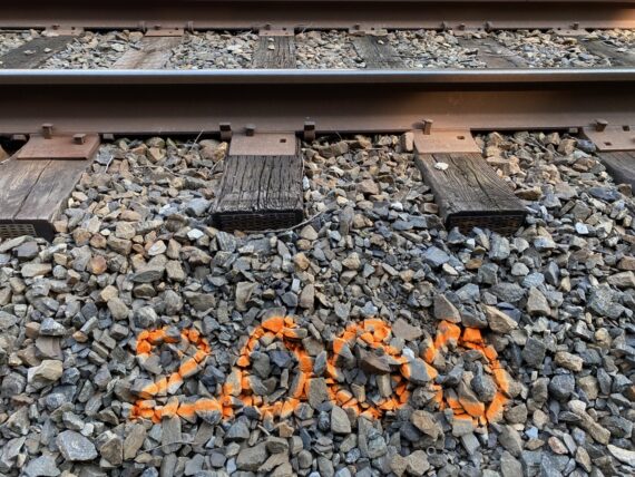
Venturing along I saw some spray paint markings presumably relating to some infrastructure maintenance…
(Since I later saw a “4000”, I’m assuming that this number has something to do with distance rather than Y2K)
Along the track, I saw this trail venturing off into the “Not Philadelphia” side and it looked like the kind of thing that neighbors might drive small ATV contraptions on…
As I took a step to take this snapshot, I heard a sound in the trees, and looked up to see a large hawk flying off behind me. So many moments of nature along the perimeter!
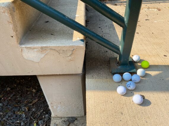
Further ahead, a strange collection of golf balls at the next regional rail station…
(There’s a golf course on the “not Philadelphia” side)
Continuing on up the tracks…
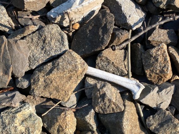
… I encountered a couple bones…
(still not a ton of dead things, but I’m predicting a deer carcass or two on segments 8 or 9…)
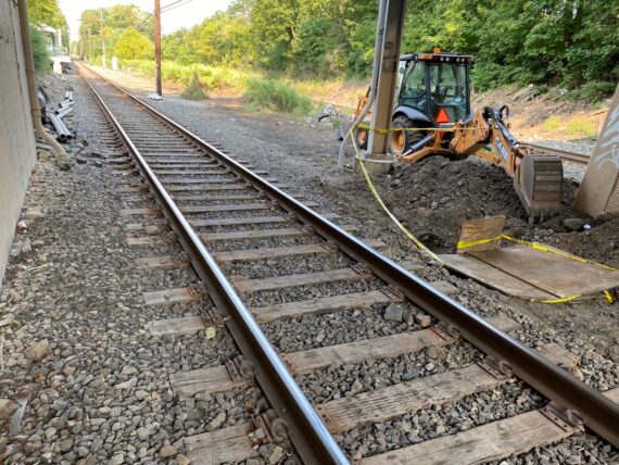
… and some signs of infrastructure work w/ this equipment and some pipe segments ahead…
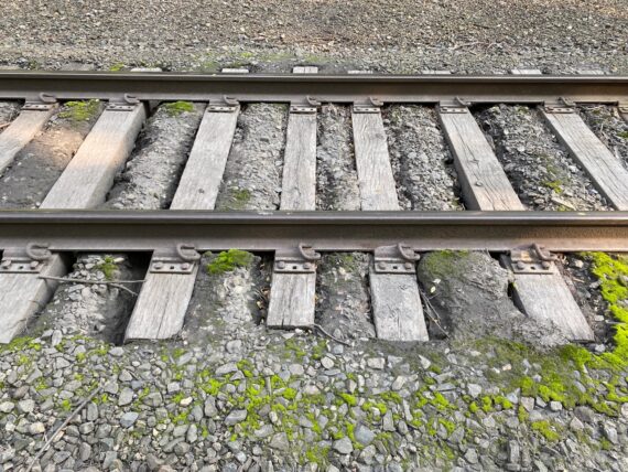
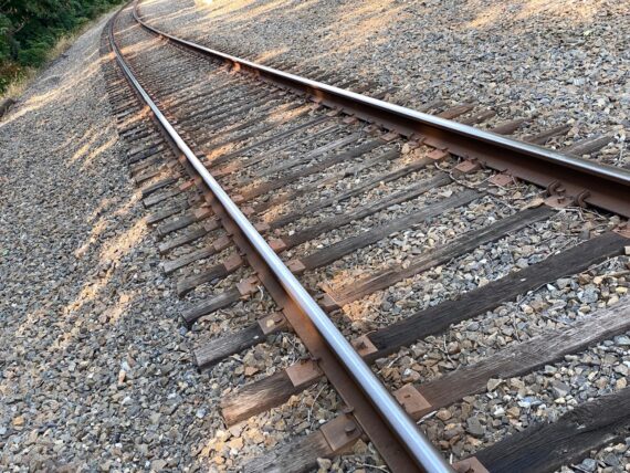
and there was something about this bit of track…
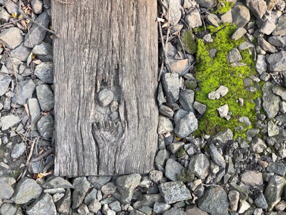
… with the bright green moss contrasted against the monochromatic wood and gravel that I found quite striking…
I knew that I’d soon need to get down from the track area and towards the road, where the perimeter again turns and follows Cottman Ave…
… and Burholme Park.
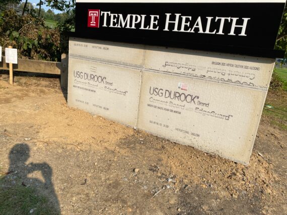
There was new signage, as Temple seemed to have some new branding / donor naming at the Fox Chase Cancer Center…
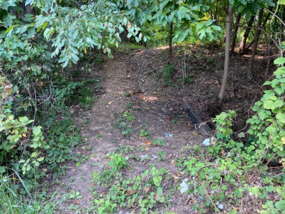
… and rather than follow the sidewalk, I opted to cut through the woods for a bit more shade & nature.
As I got into some deeper grasses, I thought to myself that I should do a check for deer ticks at the end of this day. And then right after the term “deer ticks” floated through my mind, I looked up, and there was a deer jumping off away from me through the woods…
Getting across this type of little creek is part of the reason why the packing list suggests bringing a few plastic bags to wrap around your shoes just in case…
Having forded the creek (w/o needing the bags) I came across this old sewer access plugged up w/ a concrete slab… the smell of sewer gas was fragrant!
Coming back out of the woods, I found myself back on Fillmore St, which here is the actual perimeter border…
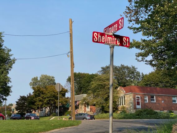
… and here I was confused… because I’d told group one that on this corner they’d run into one of those funny parts of the perimeter where you see street signs saying the same thing but in different colors… but here I could only see the red signs of “not Philadelphia”, and the green Philly signage that I’m used to seeing was nowhere to be seen…
I just went back and double checked my older photos, and I’m not crazy – it seems that that utility pole in the center of the image has been replaced, and the old one used to have green Philadelphia signs for the intersection of Fillmore & Shelmire… yet another case where the perimeter is always changing!
I was so close to the day’s end but pretty hungry so this shady edge of the woods was a good spot for a pause and snack break…
Going up through this last stretch of residential neighborhood on the perimeter, I noticed more family activity with kids outside playing and the like than I’d seen in my winter walks… but thought that I was done with any surprises as there were just a few well known blocks remaining between me and the Fox Chase regional rail station…
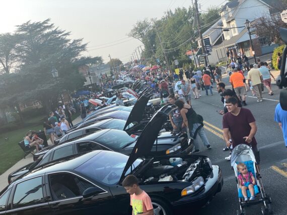
… so it was a big surprise to come across this street fair / car show situation that apparently is a yearly happening here on Huntingdon Pike…
It seems that Group 1 hadn’t seen any of this, so again this is a case of how the experience of the perimeter really changes moment to moment…
With the next train not for over an hour, I thought that I might take a pause at a nearby pub, but this one that I’d passed many times seemed to have shut down… there’s been many such local business casualties of the pandemic & associated shutdowns of course…
… and so I opted to hop on a bus…
This bus would take me to the Broad Street Line, which could get me to the trolley back to my house pretty straightforwardly. There’s always many roads home!
(again, thank you SEPTA!)
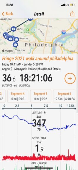
And so that’s it for the first weekend – each of these segments ended up being closer to 12 miles with all of the assorted adventure zigzagging.
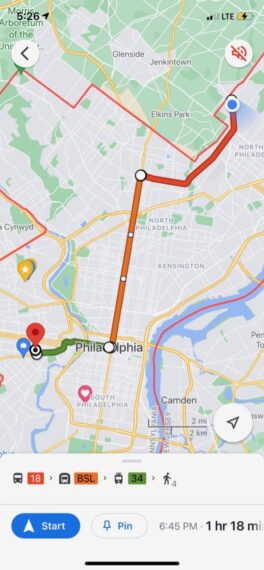
There’s seven more opportunities to join a group walk via the Fringe Festival:
Next weekend we tackle the great Northeast (Sept 18/19), and the following Sat/Sun/Mon follows the Delaware River border (Sept 25/26/27).
Then on Oct 2/3, we’ll walk all the way around the airport and follow the perimeter up Cobbs Creek right back to the start point. Then join us that evening at 7pm for the virtual reportback via zoom.
You can also register to organize your own group to explore on your own time, or just join for the reportback even if you didn’t do any of the walk…
Thanks for joining me on this adventure, and please share the info / invite with anyone that you think might enjoy it…
UPDATE: recap of Weekend 2!