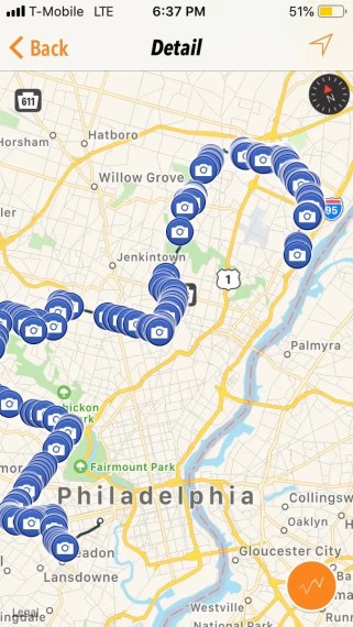
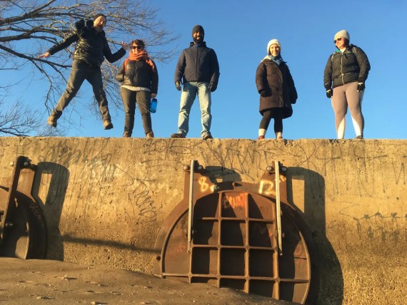
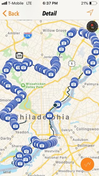
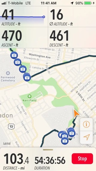
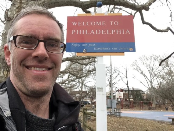
Fourth annual Walk Around Philadelphia is complete!
The amazing experience that was Walk Around Philadelphia has birthed an annual perimeter pilgrimage for me…
I am immensely grateful to be able to have walked my fourth 100 mile trek around the city’s edge & experience our city in this unique way.
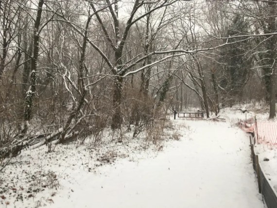
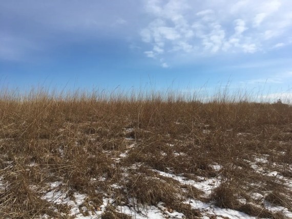
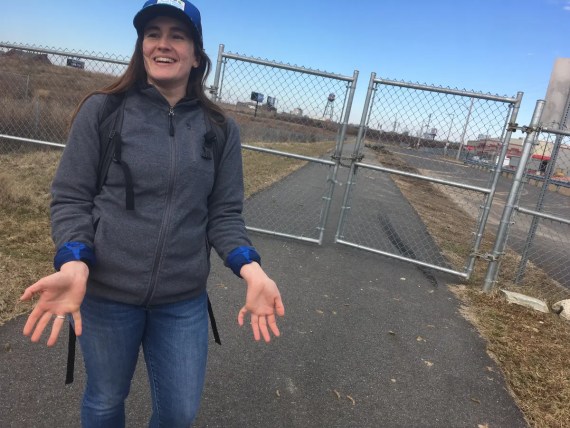
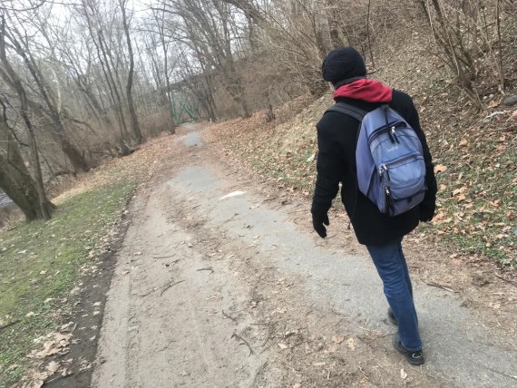
As in past years, I began the perimeter walk awhere Baltimore Ave hits the western border of the city at Cobbs Creek Park. Each year I’ve done it in mid February, and this time Day 1 started on a snowy Monday….
Note: these aren’t my finest images – my focus here was on being present as a walker, not as a photographer. I just took occasional quick cell phone snaps to document the way, particularly where things were different than in past years.
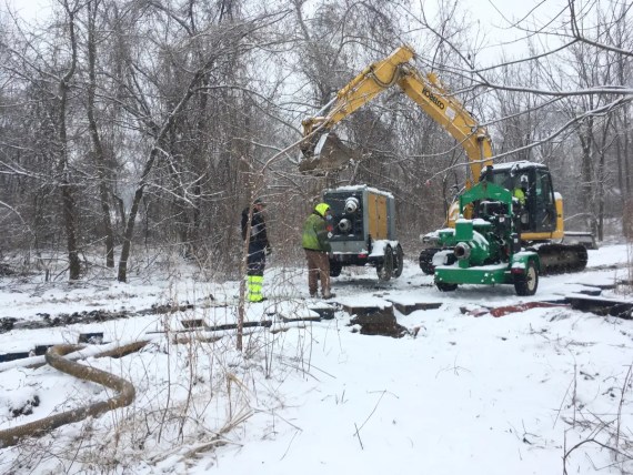
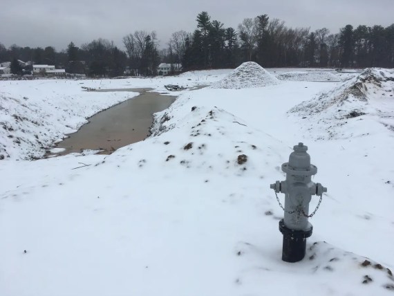
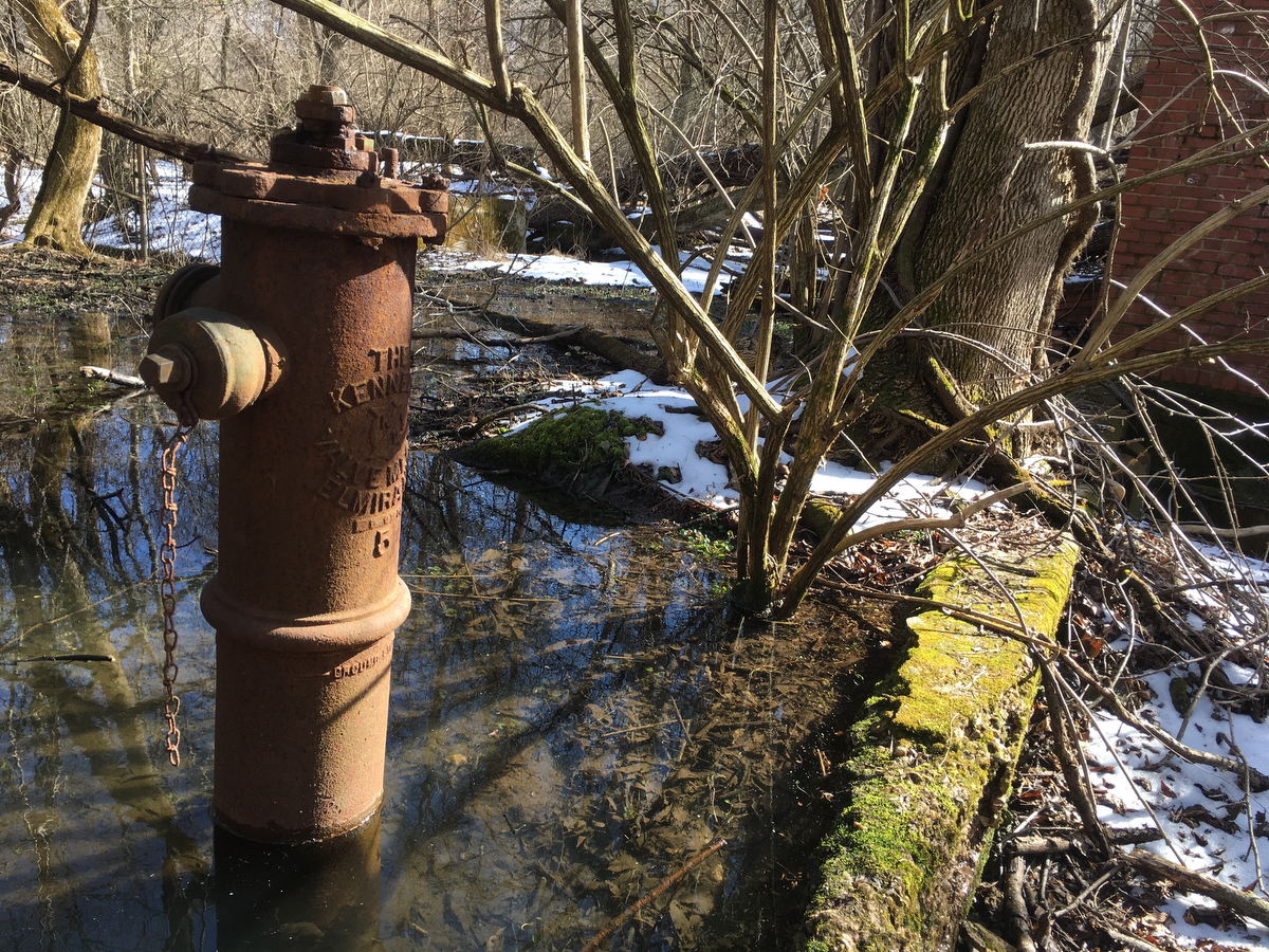
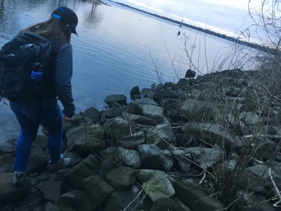
Coming up out of Cobbs Creek, the border runs along some golf courses that are usually pretty deserted in the wintertime… but this time I found some folks working on the sewer mains… not everyone got a snow day.
The transition out to City Line Ave is an abrupt one… the border switches from a creek in the woods to a manmade road, and the onslaught of traffic is jarring after a few mile’s walk in the hush of snow-covered woods…
Having already walked roughly the same route the three prior years, the city’s perimeter feels so familiar. Even the second year that I walked it I felt like I was coming back to visit an old friend…
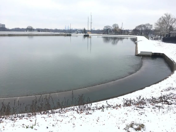
… I come back to the Belmont reservoir remembering how it looked the first year when Ann, Adrienne, Sam & I walked the whole perimeter together in an adventure of discovery… and then how in 2017 it was drained and empty for some sort of renovation.
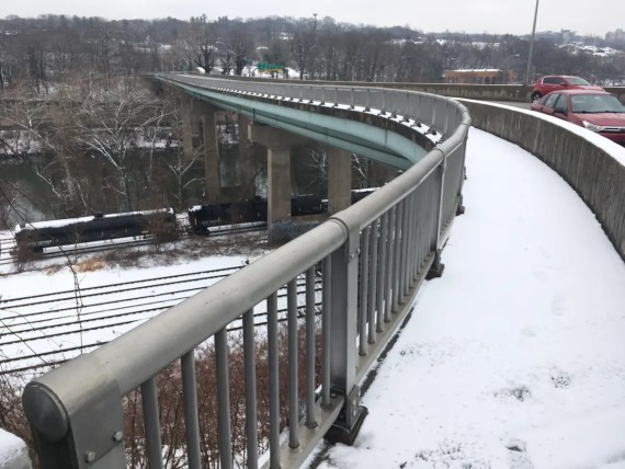
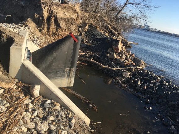
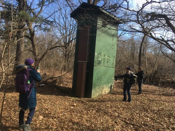
As I cross over the Schuylkill River towards Manayunk…
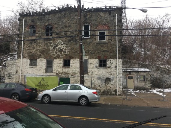
… I find the same old structure that’s been there forever, but this year it has fencing around it and a construction company banner, so I imagine that it might look quite differently when I do my 5th walk (tentatively scheduled for somewhere ~Feb 8-16 2020)…
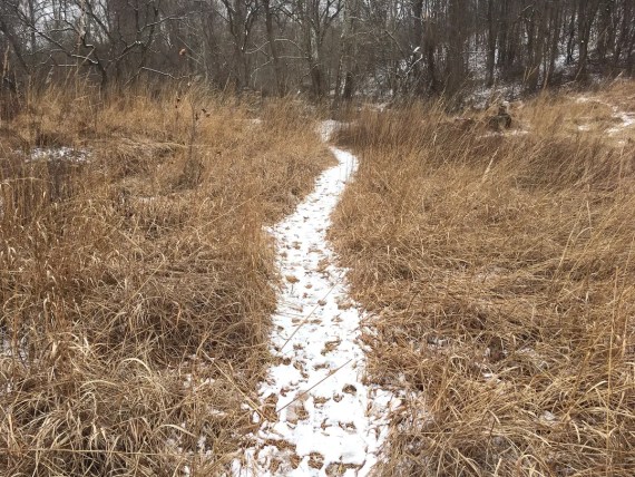
Here the freshly fallen snow helped highlight a new trail that I’d not seen before….
I’m skipping ahead a bit here, in order to give you the whole perimeter in one post rather than the more detailed day-by-day kind of posts that I’d like to write.
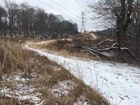
That trail brought me up into a wild new open hilly landscape that almost felt like a ski slope as I came up behind Manatawna Farms…
… I made this day a longer day, trekking on through further than we had on the first year, pushing all the way through 22.4 miles to end up in Chestnut Hill, knowing that the next morning I could catch the first train out in the company of a friend who was working an early morning shift at Weaver’s Way Co-Op.
Day 2 promised to be a test of sorts:

The forecast called for sleet and freezing rain, putting to the test that old Scandinavian proverb that “There is no bad weather, only inappropriate clothing…” – I was grateful to be well equipped.
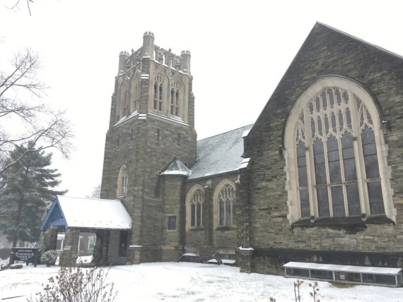
The walk down ice-covered Cheltenham Ave was lovely, and a good example of how much an experience can change with subtle changes of timing. This time around I happened to be passing by just as the bells were ringing at this church, which was a delightful surprise…
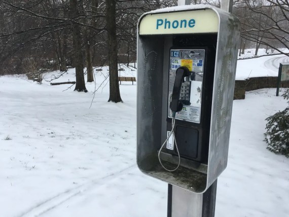
.,. as was finding out that this payphone way up at the top of the Pennypack trail actually works!
Well, sort-of. I was able to call my fellow perimeter-walker Ann, who has a 215 number. But it failed to connect with Sam’s 717 one, and Adrienne was in Copenhagen so I didn’t even try bothering her…
Coming up along the top edge of the city…
There was an open landscape of construction that was on its way to becoming a new housing development…(
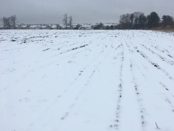
… it had previously been fenced off, but here I was able to walk clear across it this time, hewing closer to the actual border… until I hit the fence at the other end and still had to make my way back to Pine Road, which at this point is technically a bit outside of the border.
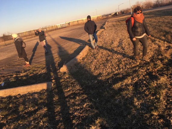
(Yes these photos are underexposed and a little gray. No I didn’t even go to the trouble of sliding in a bit of exposure compensation, or editing them afterwards… it was all about the walk then, and now it’s all about the story, and in case you missed it, I’m identifying less and less as a photographer these days…)
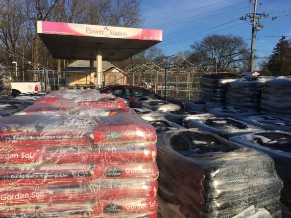
Day 3 started off sunnier, coming from the Philmont regional rail station up by the Flower Station (a lovely defunct gas station converted to a garden center…)
(I’d taken a little day off on Wednesday, having already walked 38.5 miles straight into several hours of exuberant dancing at West Philly Orchestra‘s Tuesday night Balkan brass band dance party, and needing some time to attend to far more pressing emergencies in my community)
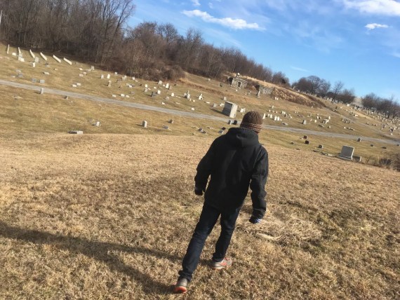
As I walked up into Forest Hills / Shalom Memorial Cemetery, it was interesting to see…
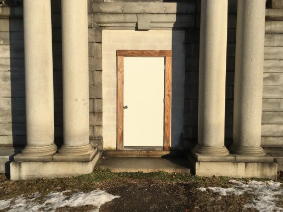
… this door implying a new arrival in this big old crypt.
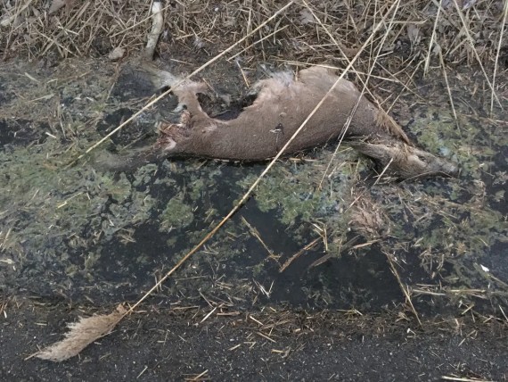
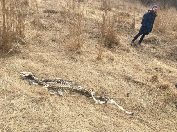
This wouldn’t be the only sign of death that I’d encounter on Day 3…
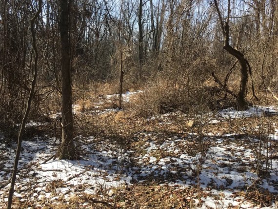
… because as I headed into the brambles of the Poquessing Creek, which defines the NorthEast border of the city…
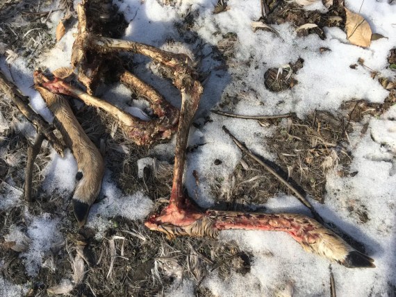
… I saw several more signs of death.
But…
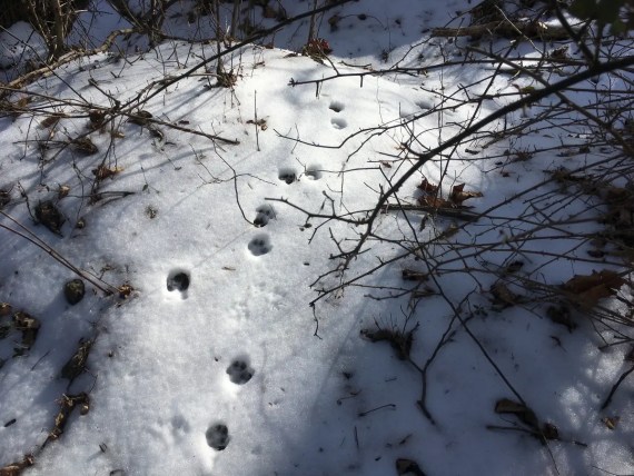
… having snow on the ground also revealed many more signs of life, and I spent many parts of Day 3 feeling like I was following animal guides who’d marked out the way through the brambles for me.
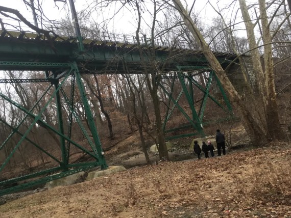
Sometime after passing under this rail bridge…
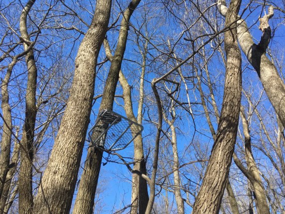
… I caught a glimpse of this hunter’s seat up high in a tree…
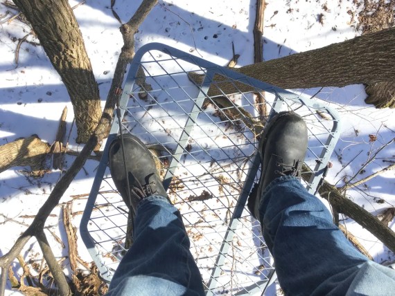
… and gave in to the temptation to climb up on it, which is maybe not the wisest thing to do with a rickety thing when you’re alone in the woods…
… but I made it down and through and past these new houses up near Roosevelt Blvd, which had been actively in construction when we first walked the perimeter in 2016.
After a lunch pause at Andy’s Diner, I took a 20 min nap in this lovely meadow in Benjamin Rush State Park.
Wanting a break from the brambles of the creek, I decided to veer slightly further from the actual border and take the path through the park…
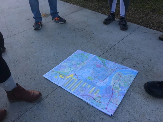
… until I glanced at my map and noticed this:
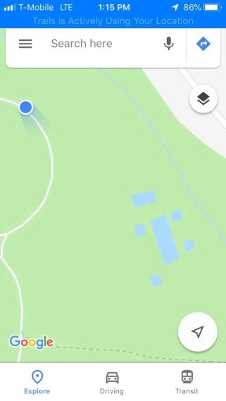
What on Earth were those strange blue rectangles?
Satellite imagery showed only tree cover, but clearly Google seemed to think that there were secret swimming pools in the woods, so I dove back into the brambles to investigate:
All of the battling of the brambles was worth it to find these strange ruins…
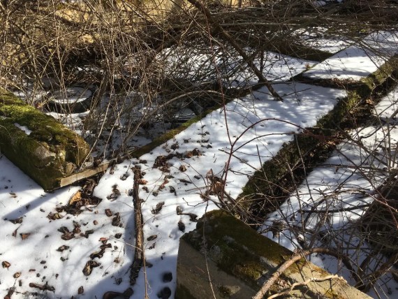
What legacy of Philadelphia’s industrial past lies hidden in Benjamin Rush State Park?
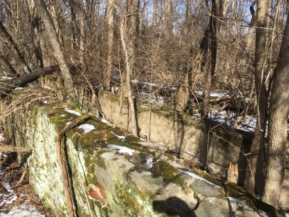
Neither the state park page nor the Wikipedia page give any hints…
… but clearly something used to happen there that involved water…
… potentially deep water…
Right after the park is a chunk of land owned by the US National Archives, and I wasn’t expecting any surprises here until I rounded a corner and saw this…
I guess they need more storage space and are building a new warehouse?
I’d never seen this kind of modular construction before so I edged in closer to ask the construction workers how long ago they’d started putting that wall up…
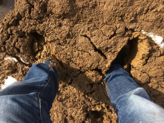
… and I promptly sank into some deep deep mud.
The answer to that question, in case you were wondering, is “5 days.”
It will take me longer than that to get those boots clean.
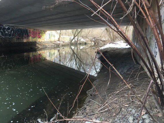
I did another bit of battling through brambles and under bridges…
Remember that if you undertake to Walk Around Philadelphia yourself, you can do it by whatever path you choose. The rules are to stay safe, stay as close to the perimeter as you can get within reason and your own comfort, no breaking into anywhere, and if you encounter an obstacle you just go around it. Like a Roomba.
But one of the fun things about taking the path through the brambles rather than following nearby roads is that you might run into places like this:
… where some folks have a little secret hangout spot in the woods…
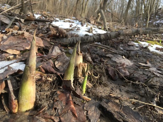
… or as you walk through the muddy lands down below and behind the parking lot at Philadelphia Mills Mall you’ll find signs of spring poking up…
(the first time around we’d walked at the top of the hill and edge of the parking lot, which is its own adventure)
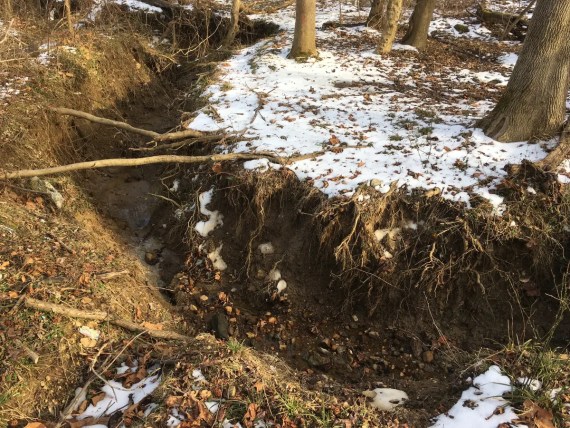
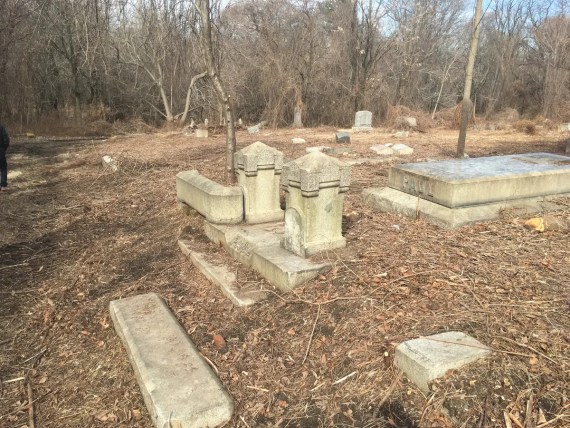
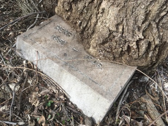
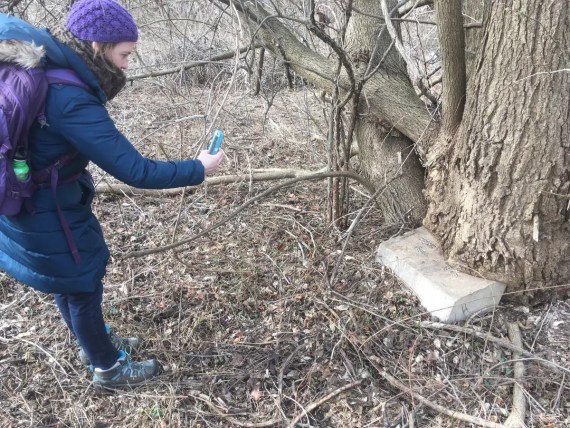
…where down here below I was expecting to find not only erosion but a graveyard of abandoned shopping carts (which we’d seen in years past)…
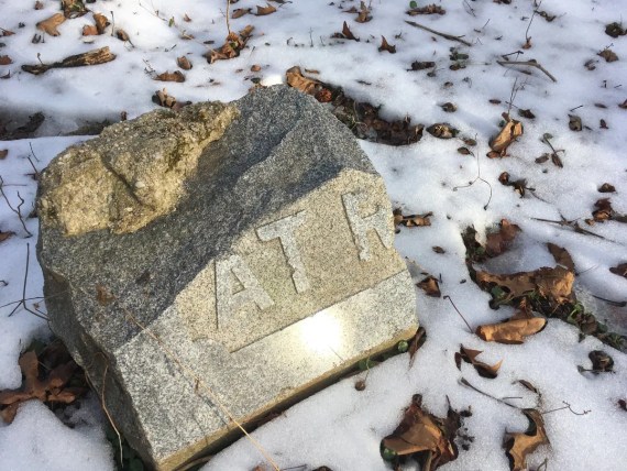
… but not these broken stones from actual graveyards!
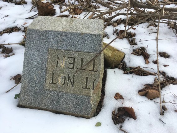
How they got down there… I have no idea.
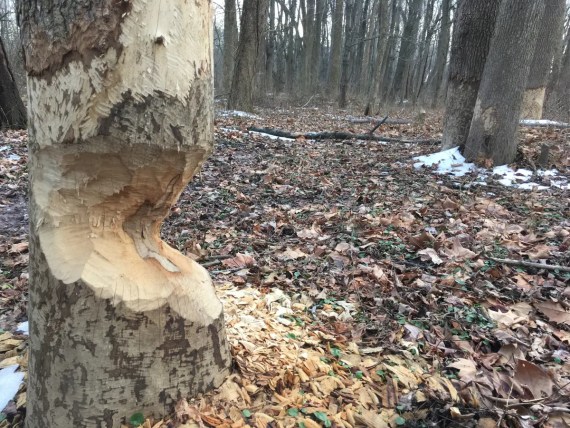
The Poquessing Creek down below Philadelphia Mills Mall also shows abundant signs of beaver activity… Maybe someone should let Tom Witmer & WHYY know about this?
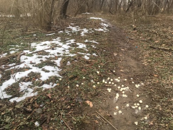
Coming along a bit further down the creek I saw other unusual signs of activity and I was perplexed by these little white balls, at first thinking them to be some type of mushroom…
… but a closer inspection revealed that some folks had been having a paint-ball battle in the woods or some such. I hope these are biodegradable…
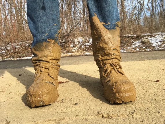
I made it to Torresdale by dusk, having walked over 50 miles, with my toes quite sore from the big boots that I wore through the creek.
(They’re maybe half a size too small… but the best shoes I have for all of the trekking through brambles.)
At this point I was somewhat regretting the schedule that I’d set, because three more days of long walking in a row was sounding painful.
(I’d forgotten that the first time that we did the walk, we’d taken two days off, whereas this time I’d only given myself one…)
But Day 4 is where the reinforcements came in:
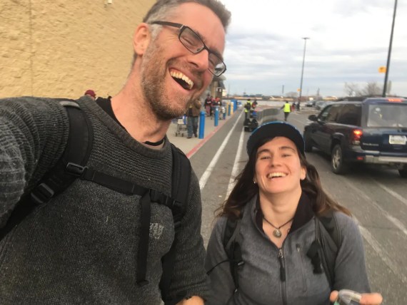
I was delighted to be joined by my original perimeter-walking friend Sam, as we reminisced on that first glorious morning of 2016 where the river at Glen Foerd had been filled with shards of ice at sunrise…
It was great to have a chance to catch up with Sam, and much of the Delaware is long stretches that hadn’t changed much, so I barely took any photographs on this day…
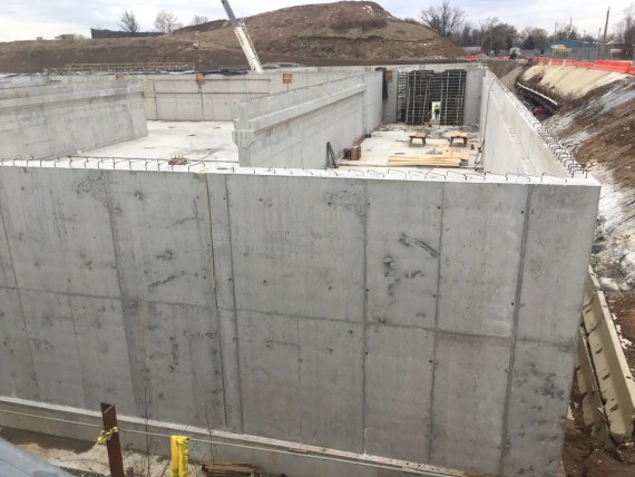
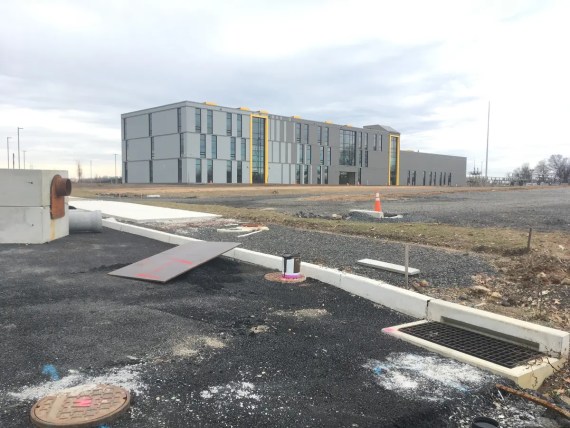
But did have to stop and appreciate the massive new structures being build for the City’s Water Department…
(One of the things about walking the perimeter of Philadelphia is that it really gives you a sense of awe for the scale of the city and all the interconnected systems that comprise it…)
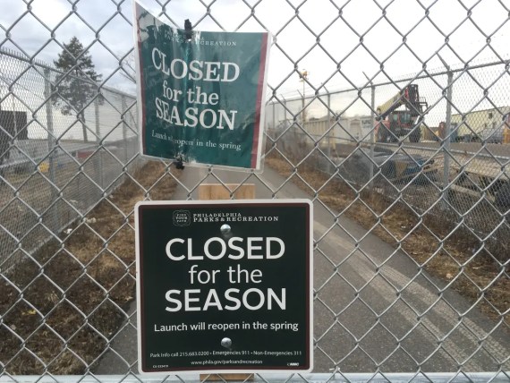
We also felt some frustration for the bureaucracy that closes down this beautiful segment of the Delaware River Trail “for the season”… as if there’s a “season” for walking?!?!
(I can understand that there might be some justification for shutting down the boat launch, but why not just build a fence around that then? Blocking off a few miles of beautiful river trail is disappointing…)
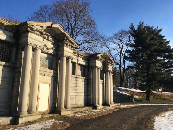
We took a little detour to see if we could find our way onto the trail via a different access point, and wandered our way into this discovery:
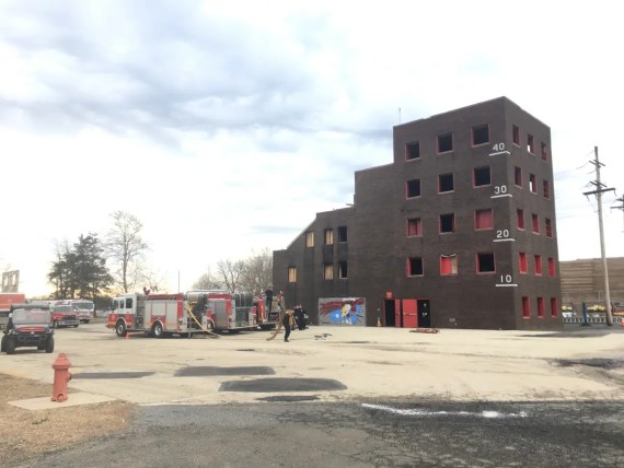
… the building where the Fire Department trains…
… which unsurprisingly has some burnt things.
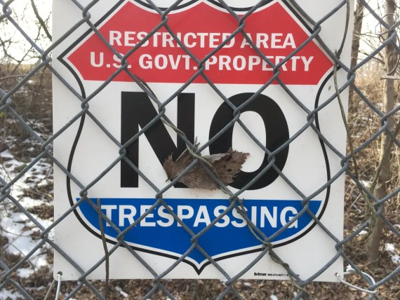
Along our way down State Road, we came across an interesting new building…
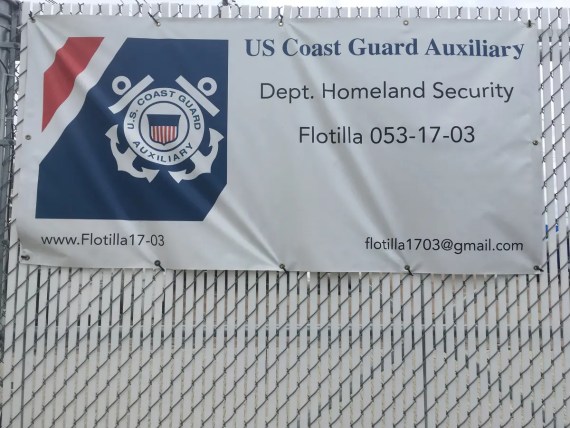
… and were amused that the Dept of Homeland Security was using regular old gmail addresses…
(Also, that web URL is missing something… .com? .us? .gov?)
Speaking of absurdities… somewhere along the way at Lardner’s Point Park, we’d been able to get onto the Delaware River Trail quite easily and clearly, and enjoyed walking that beautiful new trail until…
… we find ourselves on the wrong side of a locked gate over by the Dietz & Watson plant, because (as noted above), the Frankford Boat Launch was closed for the season.
(This is a theme along the perimeter… strange places that are fenced in, but only partially… so depending on which angle you come at them from, you end up wandering in and then having to climb out…)
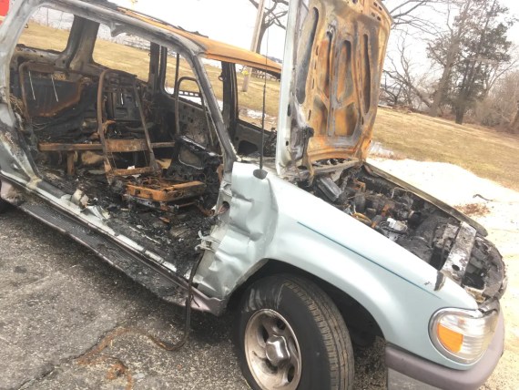
Further along the Delaware are some strange open wasteland areas…
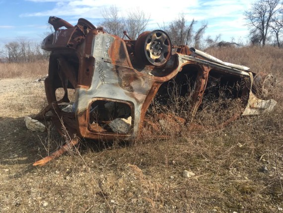
… and while the earlier depicted burnt out car made sense at the Fire Dept Academy, this one seems like a real mystery.
Continuing on our trek through these areas that feel like meadows but show traces of an industrial past with wall fragments etc…
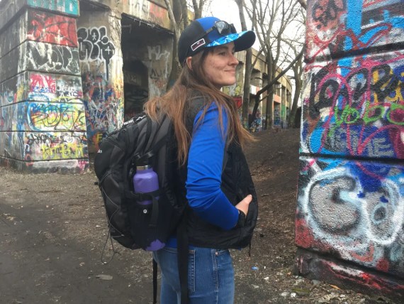
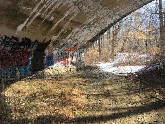
… we find ourselves at Graffiti Pier, where apparently everyone in the world had decided to come exploring on this nice sunny Friday.
(There were maybe 8 or ten other folks in assorted groups coming for sight-seeing, and apparently a railway police officer of some sort shooing people away. When we heard this, we just hoped that they would shoo us towards the closer way out to the South, which would be fine with us as that was the continuation of our journey. We didn’t even catch a glimpse of this alleged officer though, and continued on out on our own…)
The rest of the Delaware is fairly familiar territory more closely associated with my everyday life:, through Penn Treaty Park, Penn’s Landing, etc…
… although I hadn’t yet seen the new Cherry Street Pier and it was nice to have an option for a bathroom break there.
We ended our day, as planned, in the Wal-Mart parking lot. What a gift it is to spend a whole day walking with a friend!
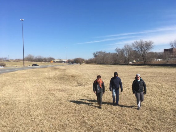
Day 5 started off in the early pre-dawn light…
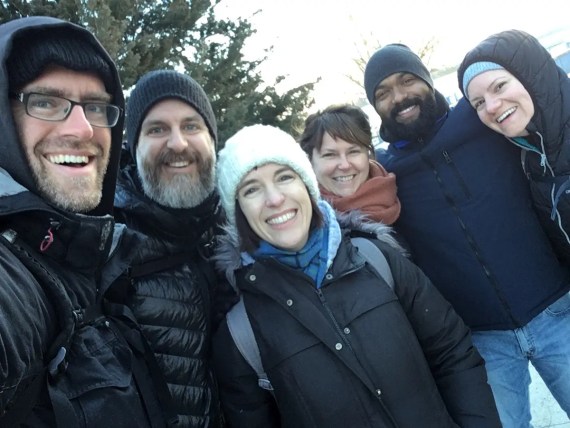
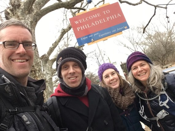
… this time accompanied by a larger group of friends old and new.
(Thanks for walking with me!)
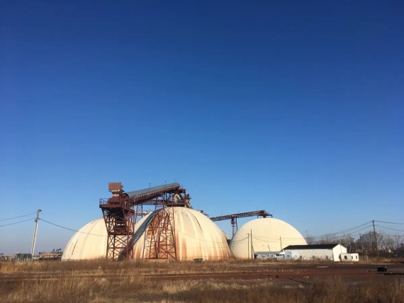
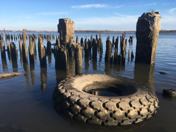
South of the Wal-Mart, things turn industrial pretty quickly… there’s lots of shipping containers, and then these beautiful strange domes…
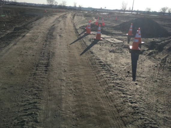
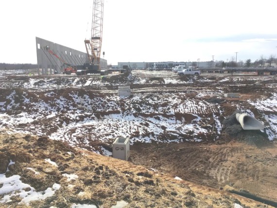
Heading south, we found signs of construction: it seems that the vast parking lots where the cars are stored after having been unloaded from ships were being redone…
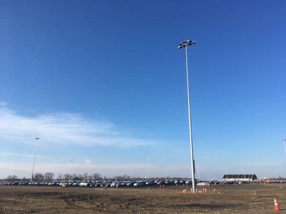
… which allowed us to trek through the southeastern corner of the Navy Yard: an area that had been off-limits in past perimeter pilgrimages.
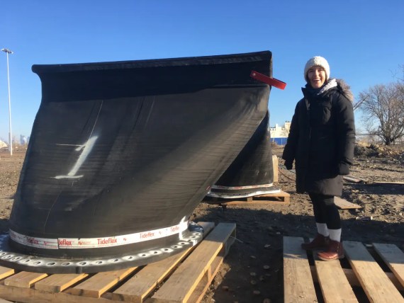
We caught a glimpse of these giant rubber structures…
… which turn out to be outflow valves for the runoff from the parking lots as they channel water into the Delaware River.
This is clearly new infrastructure being installed…
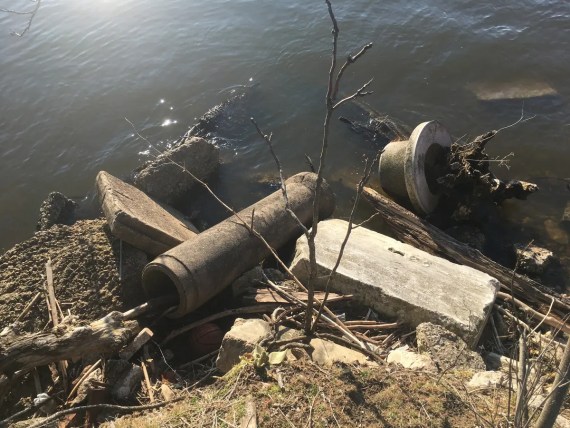
… while signs of older infrastructure was still evident on the riverbank.
We steered clear around the far edge of the lots, coming to another strange spot with a partial fence:
While it would have been easy to walk into the lot fun of cars, the direction of the barbed wire clearly told us that we were supposed to be on the left side of the fence, so that’s the path that we took.
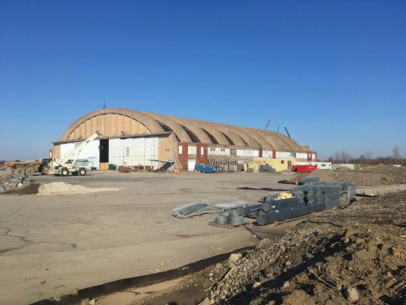
We found ourselves shunted onto another construction site as we neared this strange old hangar structure…
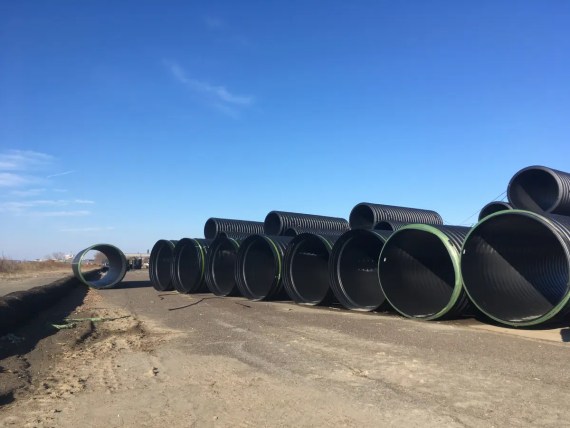
… while other bits of giant piping stood by for use in drainage in the new parking lots. And as you would have it…
… we found ourselves on the wrong side of a fence again and this time had to wriggle underneath it to escape into the main area of the Navy Yard.
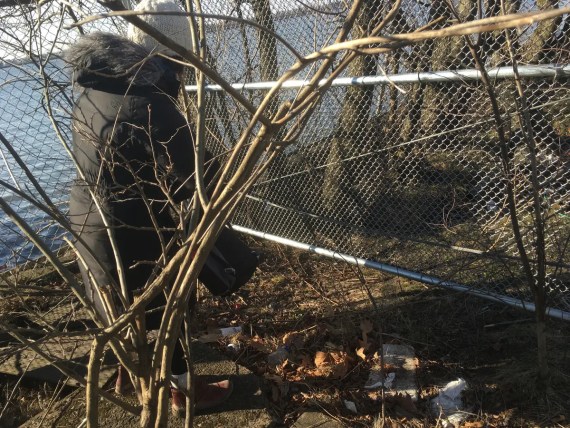
As we wandered through the Navy Yard, we caught glimpses of deer in the yards to our right…
(not pictured – I wasn’t shlepping the gear to be a nature photographer on this trek…)
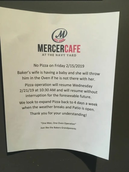
… and took a pit stop at the Mercer Café, where this note adorned the bathroom.
We got a good laugh out of it and send many best wishes to the baker, his wife, and their family.
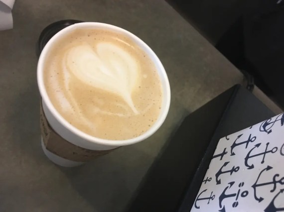
The barista working at Mercer Cafe was pretty excited about this pretty drink that she for a member of our walking crew – it was the first heart that she’d ever poured, and we were delighted to be there for it.
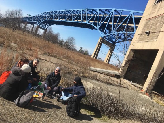
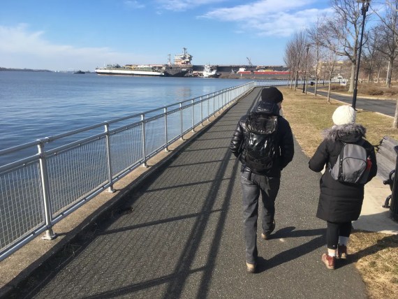
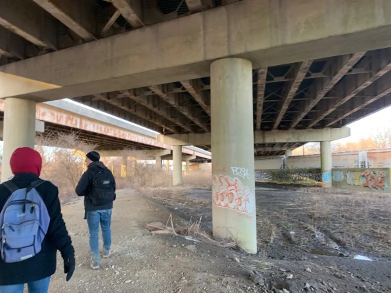
As we continued through the rest of the Navy Yard, we took another pause for a little picnic under the I-95 bridge.
Our conversation here turned to death and end-of-life practices… it’s amazing how walking together often opens up a space for richer & deeper conversations and connections, even amongst people who’ve just met.
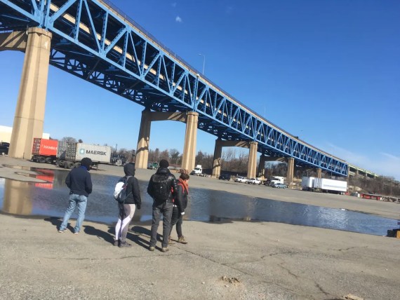
As we walked out of there and prepared to cross the Schuylkill River, looked up and noticed that there actually IS a footpath on the I-95 bridge… it’s just underneath it!
This was exciting, because when preparing for our first Walk Around Philadelphia, we’d done some reconnaissance via Google StreetView and ascertained that there wasn’t a pedestrian option on I-95 and so decided to walk across the Platt bridge…
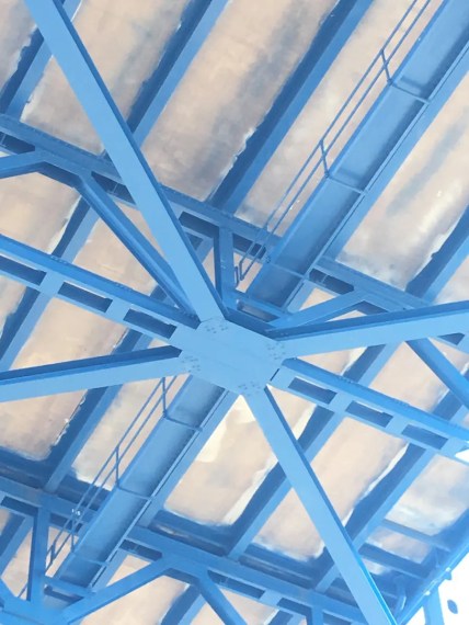
… but this path is technically closer to the perimeter.
So who do I need to talk to to get up there?
In the meanwhile, the last bit of the Navy Yard took us past the TastyCake factory, where one of the secret ingredients is:
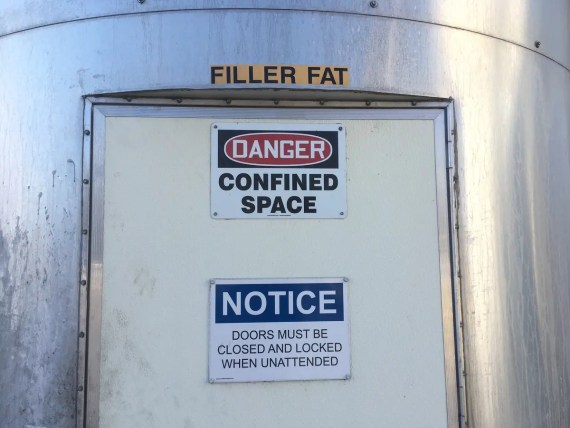
“Filler fat.”
Yum.
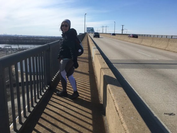
As we started to make our way across the Platt bridge…
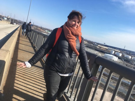
… we were delighted to find ourselves in this strange space that many of us had driven on the way to the airport, but is rarely traveled by pedestrians…
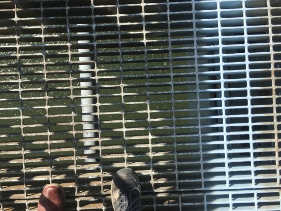
… and where those struggling with fear of heights face a real challenge on the top part of the bridge where the grates give you a great view.
(Wikipedia tells me that the whole bridge is ~1.6 miles long, but doesn’t tell me how high we were here. It can get pretty dizzying looking down!)
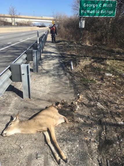
This wasn’t the first time that I’d witnessed gruseome roadkill carnage in this particular spot.
While we were certainly doing better than this poor creature…
… we were feeling pretty wiped out after having already trekked quite a bit through the morning. We were ready for a lunch break at the airport bar at the Doubletree, where we contemplated a significant choice that we had to make:
Since the perimeter cuts right through the airport runway, and we can’t quite walk right across that, there’s a choice here: bypass the airport altogether, which would make this our stopping point for the day, or take the long way around Hog Island, which involves a significant detour through Tinicum Township.
As the hotel bar was somewhat understaffed for the crowd there, it was clear that stopping for lunch would make the choice for us. If we stopped to eat there, we wouldn’t have time to make it around Hog Island.
We reached consensus to close out our tab after our round of beers, and continue on, and we were rewarded by this experience:
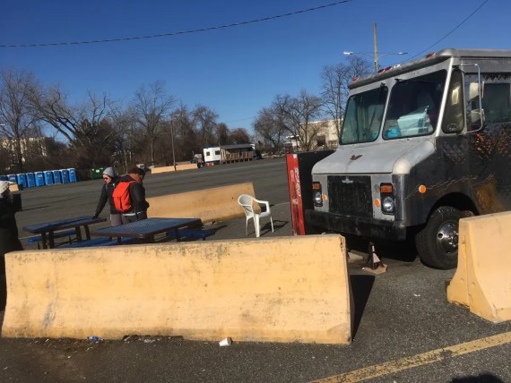
Just past the hotels is a holding lot for taxis, complete with abundant porte-potties, a small weird room with two microwaves, and a little food truck serving up cheesesteaks, french fries and chai.
We stopped for an impromptu quick picnic here and continued on…
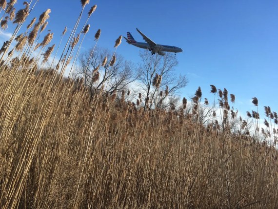
… with planes landing overhead as we did the long and somewhat monotonous trek around the vast runways…
… taking occasional inroads closer to the water’s edge for some discoveries along the way.
Meanwhile, one of our walkers was developing blisters, the sun was getting low, and we still had a long ways to go…
… but I couldn’t help but feel drawn to investigate this other little side trail towards the river where we found…
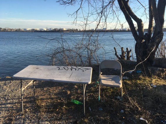
… this strange spot with evidence of a campfire, alongside of a folding table and chair tethered to a tree.
Who comes here, and what do they do here, and why?
As we came upon the last bits of the Delaware River before our path looped back up around the other side of the runways…
… we stopped for a moment alongside these pretty spectacular outflow valves.
By this point, we were feeling pretty beat…
… but still doing better than some of the deer.
What a strange sight to suddenly be coming into the familiar territory of the airport, on foot, after such a day!
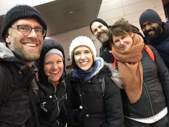
Weary but delighted by the day’s adventure, I was grateful to have had such great company for this chunk of the walk…
(Thanks Sam, Siobhan, Marc, Julie & Carlos!)
… and looking forward to the last little half-day leg…
… with another group of friendly companions joining me the next morning.
(thanks also Rocky, Elizabeth, Trish & Sasha!)
Day 5.5 involves walking out of the airport on foot, which isn’t exactly pedestrian friendly…
(OK yes technically it’s the sixth day, but we’ve always called this leg of the journey “Day 5.5” because it’s a much shorter stint under ten miles. In fact, if you didn’t take the detour around Hog Island, you could probably walk the whole perimeter in five days…)
The Heinz Wildife Refuge was a gorgeous place to be walking in the early morning, and after making our way through it…
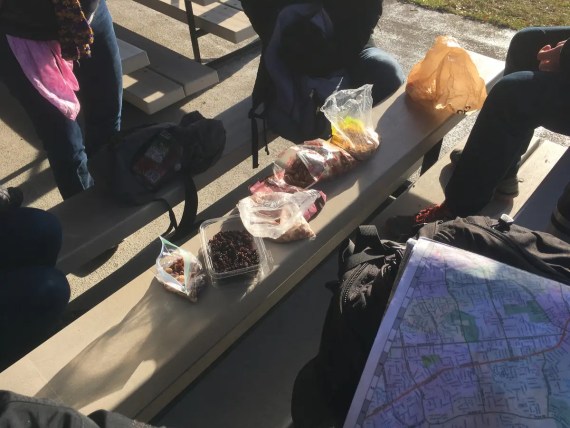
… we paused for a little round of snacks, before starting to make our way up along Darby & Cobbs Creek.
(Remember Cobbs Creek? I’d just started there at the beginning of the week…)
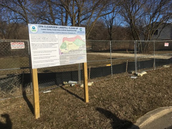
Coming up through Eastwick, we came upon a fence, and information about the EPA’s Clearview Landfill Cleanup.
When we’d first done the perimeter walk, I’d been at first delighted that this neighborhood seemed to have a beautiful park right in their back yard, and then saddened to see that it was actually a toxic waste site. So it was good to see these signs of remediation unfolding…
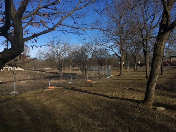
… and while this fence kept us a little bit further from the perimeter itself…
… it led me to notice this strange sculpture…
(It’s the third in a series of semi-overgrown sculptures there, but in past perimeter tours I’d only noticed the first two…)
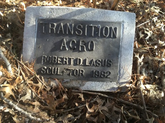
… the sculpture was accompanied by a plaque in the ground that felt more like a headstone, which was fitting foreshadowing for the next leg of our journey, which would take us past Mt. Moriah Cemetery, and many more dead things.
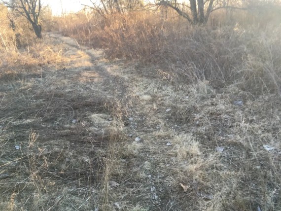
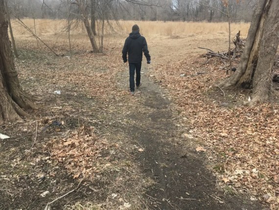
As we navigated our way along the vacant lands beside the creek…
… we soon came to one of my other favorite moments of transition on this route, where you walk out of the woods…
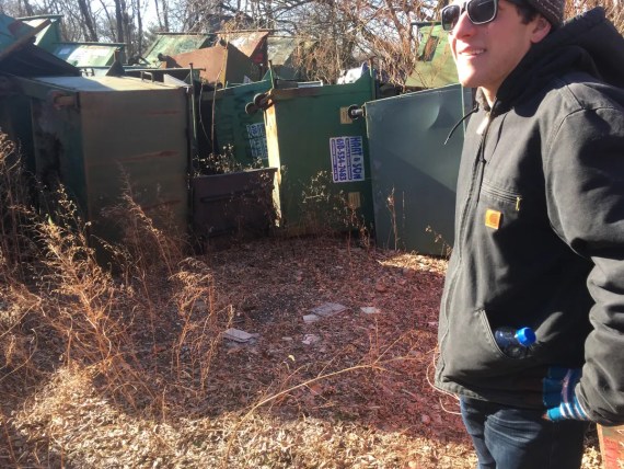
… and straight into this strange field of abandoned dumpsters.
After this brief pass through a bit more industrialized / inhabited landscape, we dip back into Cobbs Creek Park…
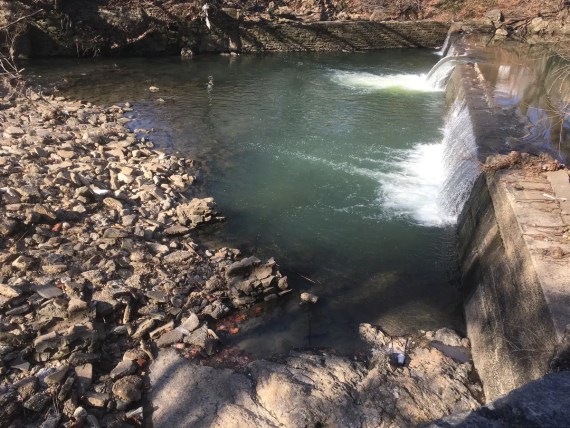
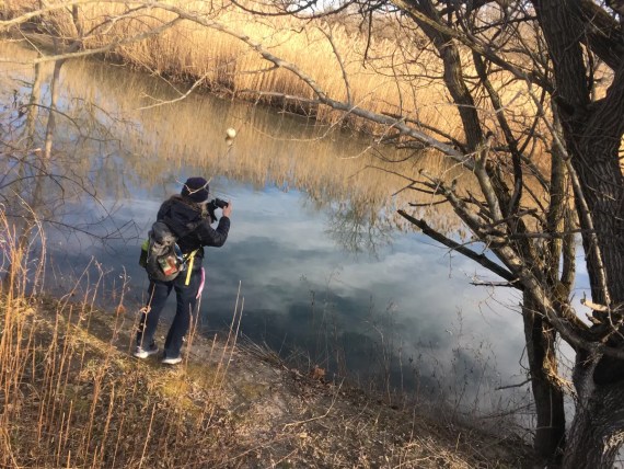
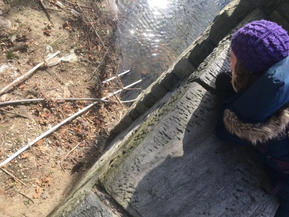
… where we caught a glimpse of this little waterfall: yet another detail that I’d walked right by three times on my previous walks, but was able to notice this time because Elizabeth drew us closer to the creek itself (and thus actual border) as soon as we entered the park again.
(Even with following the same general route every year, there’s always new marvels and discoveries if your eyes are open to them. This is the beauty of just setting out to walk and enjoy the adventure without worrying too much about the specific itinerary or being too focused on the destination. It’s a spirit of curiosity, openness and discovery that I aspire to cultivate more in my everyday life…)
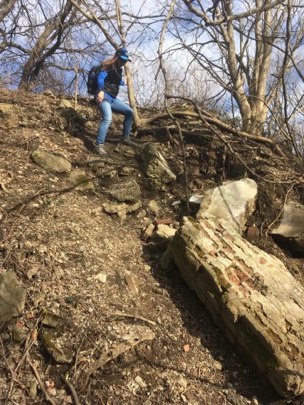
Speaking of adventure… there’s moment here where you’ve got to choose between wading in the water, walking dangerously close to traffic, taking a few block detour from the border, or scaling then sliding down this really steep hill.
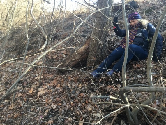
We chose the latter…
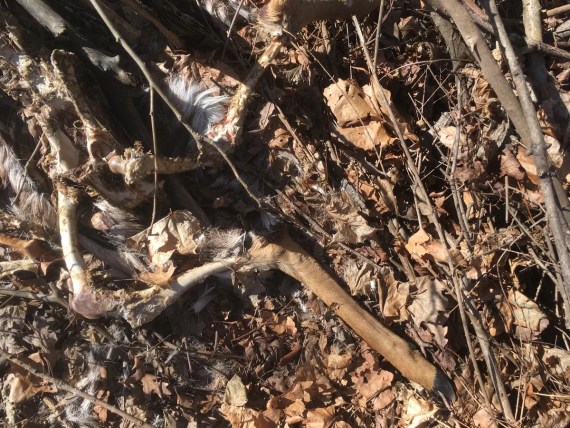
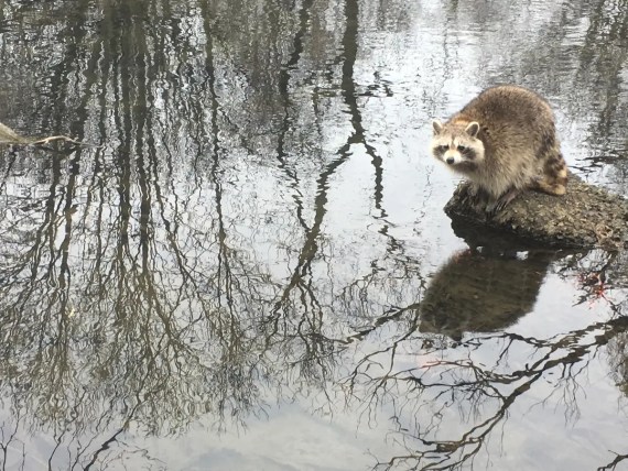
As if in preparation for Mt. Moriah Cemetery, we came across more remains of dead deer…
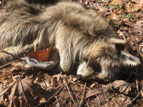
… and this dead raccoon who almost seemed to be just sleeping.
Encountering all of these signs of death around the city’s edge can be disturbing to some, but I find it quite beautiful – a reminder of our own mortality, which is the one thing that we all have in common… not just with every other human, but with every living being on this planet.
And thus how precious is this moment of life, and what a gift to be walking in the world together!
In the continued strange discoveries department, we caught a glimpse of this weird tall structure just past the entrance to Mt. Moriah…
It had what seemed like the remains of a rain-collecting gauge on it, so maybe some sort of weather-station…
… perhaps related to this (water sampling?) station that had old tubes (now disconnected) running down to the creek.
But what was truly inexplicable is that just behind it, along that slope…
… is a detail that we almost missed but Elizabeth again caught with her keen eye: down below is a big pile of compost.
Recent, household kitchen compost.
Complete with fresh-ish looking tomatoes, potatoes, avocado rinds etc.
(Dear whoever brings your kitchen compost all the way into Cobbs Creek Park to dump at the edge of the bridge into Mt. Moriah Cemetery: Who are you? What is your story? How far do you bring your compost from?)
There’s nothing inhabited around here, so this one remains a mystery… maybe someone held a big picnic in the cemetery?
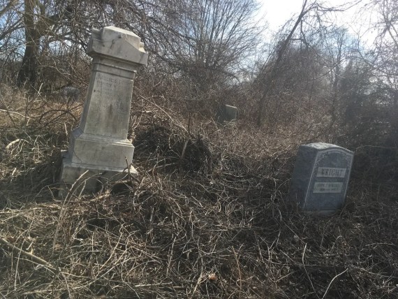
Mt. Moriah Cemetery is a pretty amazing place:
Having long been neglected, much of it was reclaimed by nature, overgrown by brambles…
… and while the Friends of Mount Moriah Cemetery have made great strides in clearing it…
… as we wandered back closer to the actual city’s edge, we found spots where nature simply would not let go…
… once it had progressed enough to engulf stones completely.
This is another one of those of those life metaphors: with slow incremental change, the wood can overtake the stone, the soft can break through the hard, and wherever there is death, new life will eventually come, in time.
Have patience.
As we entered the home stretch, and I neared the point where my hundred miles of walking would bring me right back to where I began, I wasn’t expecting many more discoveries…
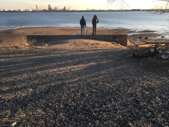
… but then we found “Raccoon Island”…
(AKA we interrupted a fishing expedition…)
… and as we headed into one of last magic meadows…
… we of course found more dead things…
… but one of the last images that struck me as we walked the last few hundred yards to 61st & Baltimore…
… was seeing this family out enjoying the park, and knowing that as we all will pass away, others will come after us to have their own adventures in this beautiful world of ours.
(So let’s do our best to be good stewards of it, shall we?)
And so here I am, having taken one more walk around Philadelphia and one more turn around the sun…
… grateful for my companions along the way.
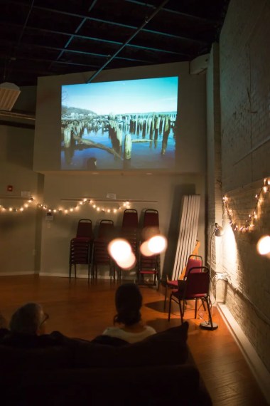
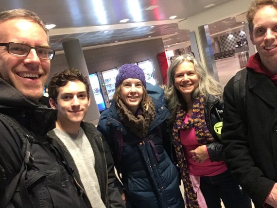
I’m also grateful to those of you who came to the perimeter walk report back / special shindig event…
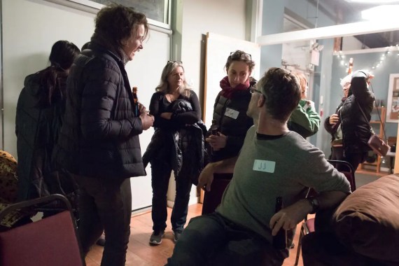
… it was great to be able to share the stories with some of you in person!
(Want invites to future events? Make sure to get on my mailing list & make sure those emails aren’t getting filtered…)
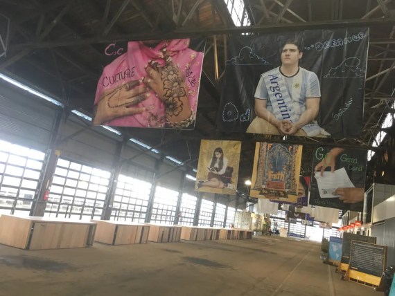
In looking at the images of my fellow walkers, and of folks who came to the event, I’m mindful that we’re not the most diverse lot…
I’m grateful for the many privileges that grant me the capacity to undertake something like this… and mindful that most Philadelphians don’t enjoy the levels of privilege that allowed us to engage in this simple act of taking time to walk the perimeter.
When we first walked the perimeter, Ann, Adrienne, Sam & I wondered what it would be like to share this kind of experience with others…
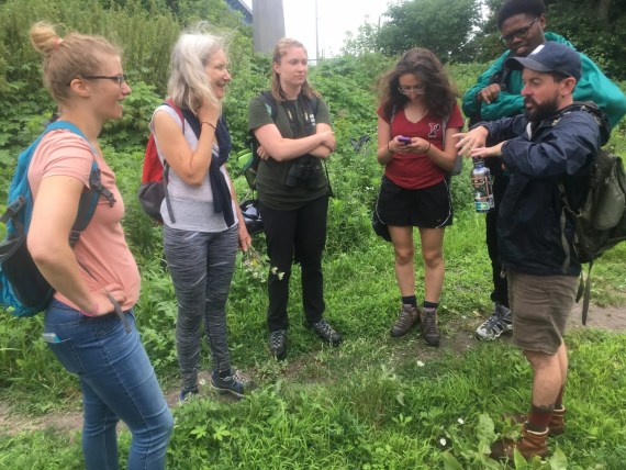
… and we had an inkling of that this summer when we shared our walking methodology with a group of students from Drexel & Penn, as wonderfully narrated by Ann here.
And so we’re curious and hopeful and open to other ways to make this kind of experience accessible to broader and more diverse audiences.
My 5th walk is scheduled for Feb 2020, but for now it’s time to turn to the next project:
Space Junk: Excavating the Tiziou Space History “museum”